
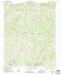
1969 Map of Burlington NE
USGS Topo · Published 1972About this map
Pleasant Grove serves as a central hub in this portion of Alamance County, where a network of secondary roads connects rural homesteads and agricultural tracts. The landscape is defined by the headwaters and winding paths of numerous watercourses, including Deep Creek and Stony Creek, which drain the undulating terrain toward the Quaker Creek Reservoir in the south. The distribution of family-named churches and community landmarks suggests a deeply rooted social structure typical of the North Carolina Piedmont during the late 1960s.
Find a feature on this map
28 named features on this map. Tap any name to fly to it.
Don’t see what you’re looking for? This feature index may not catch every label — zoom into the map to look around manually.
Map Details
Editions of this 1969 Burlington NE Map
2 editions found
Other maps of this area

1953 · Greensboro
USGS Topo · 1:250,000

1954 · Greensboro
USGS Topo · 1:250,000

1962 · Greensboro
USGS Topo · 1:250,000

1966 · Greensboro
USGS Topo · 1:250,000

1967 · Cedar Grove
USGS Topo · 1:24,000

1968 · Efland
USGS Topo · 1:24,000

1968 · Ridgeville
USGS Topo · 1:24,000

1969 · Burlington
USGS Topo · 1:24,000

1969 · Mebane
USGS Topo · 1:24,000

1969 · Lake Burlington
USGS Topo · 1:24,000