
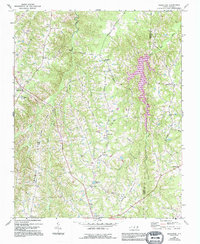
1968 Map of Ridgeville
USGS Topo · Published 1971About this map
Hyco Creek and its many tributaries, including Coney Creek and Sugartree Creek, define the rolling landscape of this border region between Caswell and Person counties. The 1968 field survey reveals a deeply rooted rural infrastructure of crossroads communities and country churches. Large family-named settlements like Hesters Store and Frogsboro serve as focal points for the surrounding farmsteads, while the southern edge of the sheet is anchored by Prospect Hill.
Find a feature on this map
33 named features on this map. Tap any name to fly to it.
Don’t see what you’re looking for? This feature index may not catch every label — zoom into the map to look around manually.
Map Details
Editions of this 1968 Ridgeville Map
2 editions found
Other maps of this area

1953 · Greensboro
USGS Topo · 1:250,000

1954 · Greensboro
USGS Topo · 1:250,000

1962 · Greensboro
USGS Topo · 1:250,000

1966 · Greensboro
USGS Topo · 1:250,000

1967 · Cedar Grove
USGS Topo · 1:24,000

1968 · Leasburg
USGS Topo · 1:24,000

1968 · Caldwell
USGS Topo · 1:24,000

1968 · Hurdle Mills
USGS Topo · 1:24,000
1968 · Olive Hill
USGS Topo · 1:24,000

1969 · Burlington NE
USGS Topo · 1:24,000