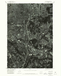
1975 Map of Gladstone
USGS Topo · Published 1977About this map
Portland and its surrounding southern reaches appear in sharp detail through this mid-1970s orthophotograph, which uses aerial imagery to document the suburban and industrial expansion of the era. The confluence of the Willamette River and the Clackamas River anchors the southern portion of the sheet, providing a clear view of the natural waterways that shaped the development of Gladstone and the community of Clackamas. Rising above the residential grids and the developing highway corridors is Mount Scott, which stands as a significant topographic landmark amidst the intensifying urban sprawl. This imagery, produced by the Geological Survey in cooperation with the Soil Conservation Service, captures the specific land use patterns of 1975, showing the transformation of previously open tracts into the modern metropolitan footprint seen today.
Find a feature on this map
6 named features on this map. Tap any name to fly to it.
Don’t see what you’re looking for? This feature index may not catch every label — zoom into the map to look around manually.
Map Details
Editions of this 1975 Gladstone Map
This is the sole edition of this map. No revisions or reprints were ever made.
Other maps of this area

1897 · Portland
USGS Topo · 1:62,500

1905 · Portland
USGS Topo · 1:62,500

1911 · Boring
USGS Topo · 1:48,000

1914 · Boring
USGS Topo · 1:62,500

1914 · Oregon City
USGS Topo · 1:62,500

1916 · Estacada
USGS Topo · 1:125,000

1918 · Troutdale
USGS Topo · 1:62,500

1934 · Troutdale
USGS Topo · 1:48,000

1939 · Oregon City
USGS Topo · 1:62,500

1940 · Boring
USGS Topo · 1:62,500