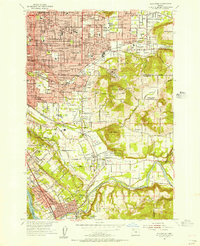
1954 Map of Gladstone
USGS Topo · Published 1956About this map
Camp Withycombe and the surrounding Clackamas River valley define the southern landscape of this mid-1950s survey. The map details the suburban expansion of Southeast Portland into neighborhoods like Arleta, Lents, and Woodstock, where residential grids meet industrial features like the Wichita Station and various gravel pits. The terrain is dominated by prominent elevations such as Mount Scott and Mount Talbert, while the residential areas are marked by numerous local institutions, including Our Lady of Sorrows School and Creston School. Significant land use is dedicated to large memorial sites like Lincoln Memorial Park Cem and Willamette National Cem. Transport networks are transitioning, shown through the intersection of the Southern Pacific Railroad and major thoroughfares like Powell Blvd and Foster Road, reflecting the region's post-war residential growth and its connection to the riverfront at Jennings Lodge and Gladstone Park.
Find a feature on this map
115 named features on this map. Tap any name to fly to it.
Don’t see what you’re looking for? This feature index may not catch every label — zoom into the map to look around manually.
Map Details
Editions of this 1954 Gladstone Map
This is the sole edition of this map. No revisions or reprints were ever made.
Other maps of this area

1897 · Portland
USGS Topo · 1:62,500

1905 · Portland
USGS Topo · 1:62,500

1911 · Boring
USGS Topo · 1:48,000

1914 · Boring
USGS Topo · 1:62,500

1914 · Oregon City
USGS Topo · 1:62,500

1916 · Estacada
USGS Topo · 1:125,000

1918 · Troutdale
USGS Topo · 1:62,500

1934 · Troutdale
USGS Topo · 1:48,000

1939 · Oregon City
USGS Topo · 1:62,500

1940 · Boring
USGS Topo · 1:62,500