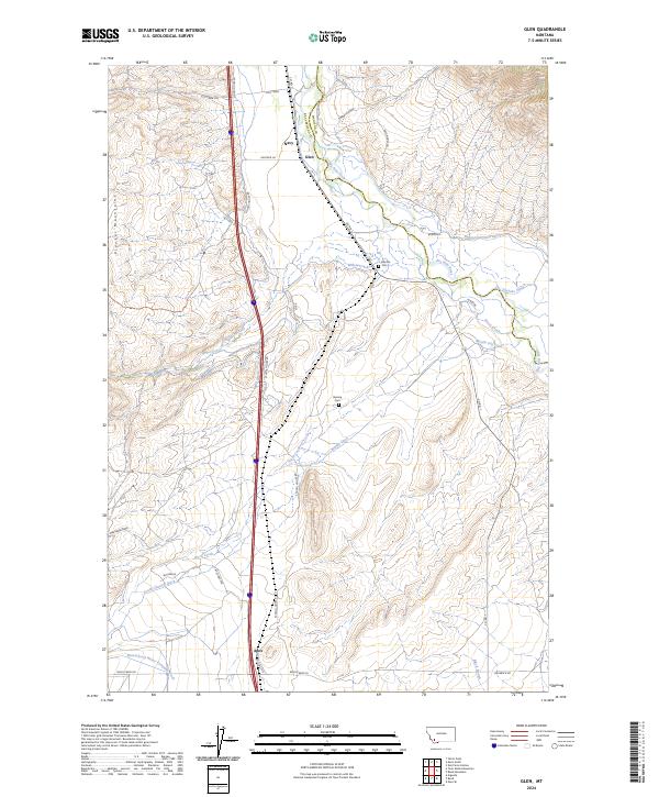
2024 Map of Glen
USGS Topo · Published 2024About this map
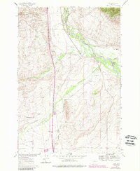
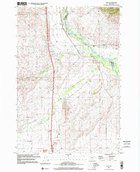
The Big Hole River winds through this section of Beaverhead County, creating a fertile riparian corridor defined by an intricate network of irrigation systems. Settlements like Glen, Apex, and Navy anchor the valley, where early agricultural development is evidenced by features such as the Beaverhead Water Company Ditch, Mantle Ditch, and Buhrer-Garrison Ditch. This reliance on water management is further highlighted by the presence of Stevens Slough and Black Slough on the valley floor.
Find a feature on this map
37 named features on this map. Tap any name to fly to it.
Don’t see what you’re looking for? This feature index may not catch every label — zoom into the map to look around manually.
Map Details
Editions of this 2024 Glen Map
This is the sole edition of this map. No revisions or reprints were ever made.
Historical Maps of Navy Through Time
3 maps found