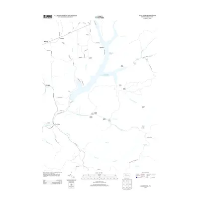
2013 Map of Glen Hazel
USGS Topo · Published 2013About this map
Elk State Park and the waters of the East Branch Clarion River Lake dominate this landscape in Elk County. The map captures a topography defined by deep hollows and high points like North Fork Summit and Pistner Hill. Settlements such as Glen Hazel, Instanter, and Rasselas are linked by a network of rural roads including Glen Hazel Rd and Instanter Rd. The drainage pattern is complex, with the Middle Fork E Br Clarion River and its various branches, like Long Br and Straight Cr, carving through numerous named hollows. This 2013 survey illustrates the modern configuration of the lake and its surrounding state park lands, providing a clear view of the area's contemporary geography and recreational infrastructure.
Find a feature on this map
73 named features on this map. Tap any name to fly to it.
Don’t see what you’re looking for? This feature index may not catch every label — zoom into the map to look around manually.
Map Details
Editions of this 2013 Glen Hazel Map
This is the sole edition of this map. No revisions or reprints were ever made.
Other maps of this area

1935 · Mt. Jewett
USGS Topo · 1:48,000

1940 · Mt. Jewett
USGS Topo · 1:62,500

1941 · Benezette
USGS Topo · 1:62,500

1941 · Ridgway
USGS Topo · 1:62,500

1943 · Benezette
USGS Topo · 1:62,500

1944 · Ridgway
USGS Topo · 1:62,500

1948 · Crosby
USGS Topo · 1:62,500

1948 · Wildwood Fire Tower
USGS Topo · 1:24,000
1948 · Crosby
USGS Topo · 1:24,000
1950 · Wildwood Fire Tower
USGS Topo · 1:24,000
Featured Places
- Saint Marys, PA
- Instanter, Jones Township
- Glen Hazel, Jones Township
- Streights, Jones Township
- Jones Township, PA