Loading...
Loading map...2024 Map of Glencoe
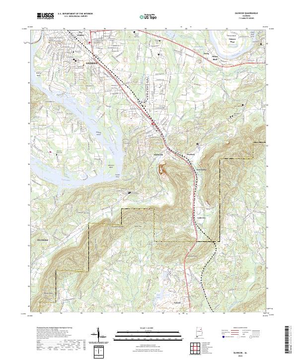
USGS Topo · Published 2024About this map
The Coosa River defines this landscape as it winds through Etowah and Calhoun counties, creating dramatic geography at Keeling Bend and Whorton Bend. The area transitions from the urban outskirts of Gadsden and East Gadsden in the northwest to the more open, mountainous terrain of Colvin Mountain and Greens Creek Mtn. These ridges are punctuated by notable passes such as Davis Gap and Alexander Gap, which influence the local transportation network including Chastain Blvd E.
Find a feature on this map
60 named features on this map. Tap any name to fly to it.
Don’t see what you’re looking for? This feature index may not catch every label — zoom into the map to look around manually.
Map Details
Date Portrayed2024
Date Published2024
PublisherU.S. Geological Survey
Map TypeTopographic
Scale1:24000
Physical Dimensions24 x 29 inches
Editions of this 2024 Glencoe Map
This is the sole edition of this map. No revisions or reprints were ever made.
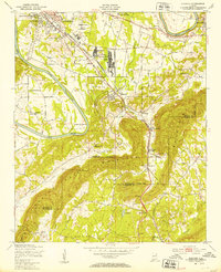
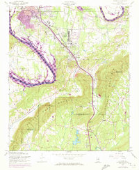
Historical Maps of Tidmore Bend Through Time
Featured Locations
Source Details
SourceU.S. Geological Survey
CopyrightPublic Domain