2024 Map of Glenn Springs
USGS Topo · Published 2024About this map
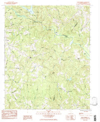
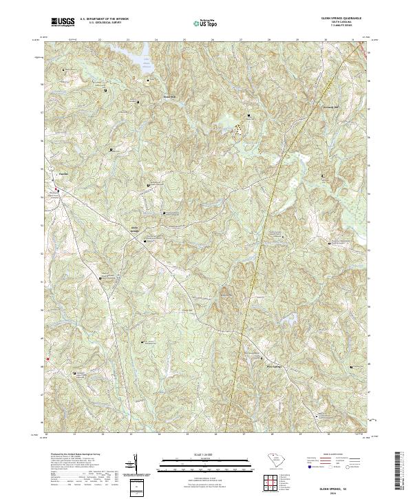
Glenn Springs and its surrounding communities are defined by a network of historic mill sites and denominational graveyards situated along the rolling terrain of the Upstate. The map details a landscape where industrial heritage and family lineage intersect, anchored by Foster Mill on Fairforest Creek and Kennedy Mill to the east. The density of religious and family burial sites, such as the Oeland Family Cem and the Philadelphia Baptist Church Graveyard, points to a long-established rural social structure.
Find a feature on this map
109 named features on this map. Tap any name to fly to it.
Don’t see what you’re looking for? This feature index may not catch every label — zoom into the map to look around manually.
Map Details
Editions of this 2024 Glenn Springs Map
This is the sole edition of this map. No revisions or reprints were ever made.