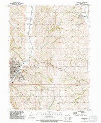
1994 Map of Glenwood
USGS Topo · Published 1994About this map
Glenwood serves as a primary hub of development in western Iowa during the late twentieth century, characterized by a concentration of educational and social institutions including Northeast Sch, West Sch, and the Glenwood State Hospital Sch. The landscape is defined by the drainage systems of Keg Creek and Silver Creek, which carve through the loess hills of Mills County.
Find a feature on this map
20 named features on this map. Tap any name to fly to it.
Don’t see what you’re looking for? This feature index may not catch every label — zoom into the map to look around manually.
Map Details
Editions of this 1994 Glenwood Map
This is the sole edition of this map. No revisions or reprints were ever made.
Other maps of this area

1935 · Nehawka
USGS Topo · 1:48,000

1940 · Nehawka
USGS Topo · 1:62,500

1954 · Omaha
USGS Topo · 1:250,000

1955 · Nebraska City
USGS Topo · 1:250,000

1956 · Glenwood
USGS Topo · 1:24,000

1956 · Mineola
USGS Topo · 1:24,000

1956 · Rock Bluff
USGS Topo · 1:24,000

1956 · Pacific Junction
USGS Topo · 1:24,000

1956 · Treynor
USGS Topo · 1:24,000

1956 · Council Bluffs South
USGS Topo · 1:24,000