2022 Map of Gold Hill
USGS Topo · Published 2022About this map
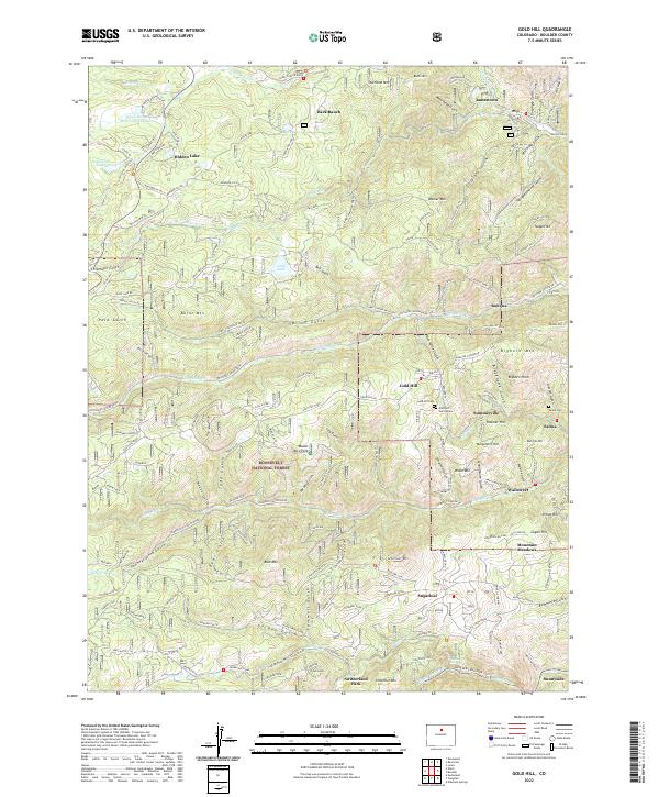
Gold Hill stands as the central settlement in this rugged section of the Roosevelt National Forest, where a network of gulches and peaks defines the landscape northwest of Boulder. The topography is dominated by steep drainages like Lick Skillet Gulch and Fourmile Creek, which historically supported a dense cluster of mining camps. Small mountain communities such as Summerville, Salina, and Wallstreet are tucked into these narrow valleys along Fourmile Canyon Drive. The map reveals a legacy of local development through features like the Gold Hill Cemetery, its Annex, and the Salina Cemetery. On the higher elevations, landmarks such as Overland Mountain and Walker Mountain rise above the scattered ranching and residential sites at Bark Ranch and Sugarloaf. This layout illustrates the transition from high-altitude mineral extraction to mountain residential life.
Find a feature on this map
130 named features on this map. Tap any name to fly to it.
Don’t see what you’re looking for? This feature index may not catch every label — zoom into the map to look around manually.
Map Details
Editions of this 2022 Gold Hill Map
This is the sole edition of this map. No revisions or reprints were ever made.