Loading...
Loading map...2021 Map of Golden
USGS Topo · Published 2021About this map
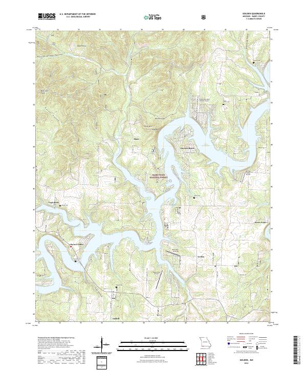
The fingers of Table Rock Lake dominate this portion of Barry County, Missouri, where the rugged Ozark terrain meets modern recreation and aviation. The community of Golden is central to the area, surrounded by a complex network of ridges and hollows including Natural Bridge Hollow, Bean Hollow, and Garner Hollow. The landscape is a mix of protected woodland within the Mark Twain National Forest and residential growth near the water at Emerald Beach and Chain-O-Lakes.
Find a feature on this map
47 named features on this map. Tap any name to fly to it.
Don’t see what you’re looking for? This feature index may not catch every label — zoom into the map to look around manually.
Map Details
Date Portrayed2021
Date Published2021
PublisherU.S. Geological Survey
Map TypeTopographic
Scale1:24000
Physical Dimensions24 x 29 inches
Editions of this 2021 Golden Map
This is the sole edition of this map. No revisions or reprints were ever made.
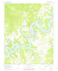
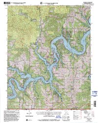
Historical Maps of Emerald Beach Through Time
Featured Locations
Source Details
SourceU.S. Geological Survey
CopyrightPublic Domain