2022 Map of Good Thunder
USGS Topo · Published 2022About this map
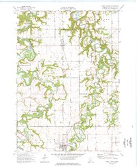
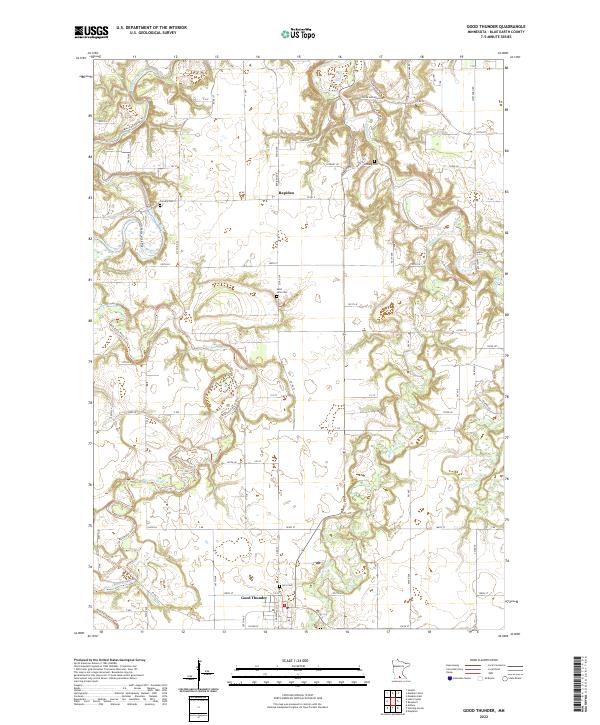
Good Thunder and Rapidan anchor this landscape in Blue Earth County, where a complex network of waterways defines the local geography. The Blue Earth River and its accompanying Blue Earth River Trl wind through the western section, while the Maple River, Le Sueur River, and Cobb River converge and carve deep paths through the glacial till of southern Minnesota. These river valleys create a distinct contrast with the rectilinear grid of township roads and agricultural fields that dominate the uplands.
Find a feature on this map
93 named features on this map. Tap any name to fly to it.
Don’t see what you’re looking for? This feature index may not catch every label — zoom into the map to look around manually.
Map Details
Editions of this 2022 Good Thunder Map
This is the sole edition of this map. No revisions or reprints were ever made.