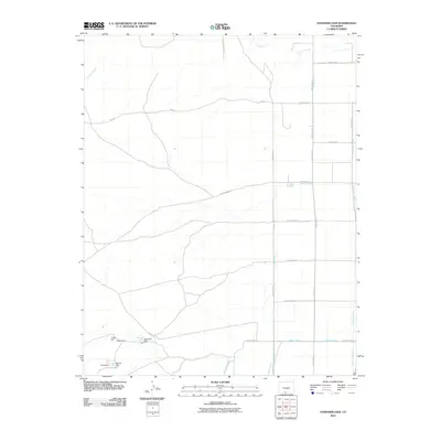
2010 Map of Goshawk Dam
USGS Topo · Published 2010About this map
Agricultural irrigation systems define this landscape in Conejos County, where an intricate network of waterways manages the high-desert terrain. The eastern portion of the sheet is marked by the long, north-south run of the Bountiful Lateral, while the Romero Ditch and Mogote Ditch crisscross the central flats to support local ranching. To the south, a cluster of small reservoirs including Goshawk Dam, Turkey Dam, Swan Dam, and Ostrich Dam provides critical water storage. The topography is further shaped by natural drainage features such as La Jara Arroyo and Las Mesitas Ditch. This 2010 survey illustrates the continued reliance on a complex hydraulic infrastructure, where County Roads like County Road R and FDR 249 navigate the spaces between these vital water lines.
Find a feature on this map
23 named features on this map. Tap any name to fly to it.
Don’t see what you’re looking for? This feature index may not catch every label — zoom into the map to look around manually.
Map Details
Editions of this 2010 Goshawk Dam Map
This is the sole edition of this map. No revisions or reprints were ever made.
Other maps of this area

1922 · Conejos
USGS Topo · 1:125,000

1945 · Durango
USGS Topo · 1:250,000

1953 · Durango
USGS Topo · 1:250,000

1954 · Durango
USGS Topo · 1:250,000

1954 · Trinidad
USGS Topo · 1:250,000

1955 · Trinidad
USGS Topo · 1:250,000

1958 · Trinidad
USGS Topo · 1:250,000

1959 · Trinidad
USGS Topo · 1:250,000

1961 · Durango
USGS Topo · 1:250,000

1963 · Durango
USGS Topo · 1:250,000