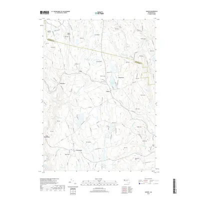
2018 Map of Goshen
USGS Topo · Published 2018About this map
The town of Goshen serves as a central hub in this Hampshire County landscape, situated at the junction of routes leading toward the Westfield River and the eastern highlands. The area is defined by its numerous small water bodies and meadows, including Lower Highland Lake and the Sears Meadow Reservoir, which illustrate the complex drainage patterns of the Swift River and its tributaries. To the south, the settlement of Chesterfield sits amidst a network of rural roads such as Stage Rd and Bissell Rd, surrounded by distinctive terrain features like Bagg Ledges and Fisk Meadow.
Find a feature on this map
126 named features on this map. Tap any name to fly to it.
Don’t see what you’re looking for? This feature index may not catch every label — zoom into the map to look around manually.
Map Details
Editions of this 2018 Goshen Map
This is the sole edition of this map. No revisions or reprints were ever made.
Other maps of this area

1885 · Northampton
USGS Topo · 1:62,500

1886 · Hawley
USGS Topo · 1:62,500

1886 · Chesterfield
USGS Topo · 1:62,500

1886 · Northampton
USGS Topo · 1:62,500

1888 · Chesterfield
USGS Topo · 1:62,500

1890 · Hawley
USGS Topo · 1:62,500

1890 · Greenfield
USGS Topo · 1:62,500

1891 · Northampton
USGS Topo · 1:62,500

1893 · Northampton
USGS Topo · 1:62,500

1893 · Chesterfield
USGS Topo · 1:62,500