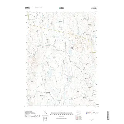
2021 Map of Goshen
USGS Topo · Published 2021About this map
The hill towns of Western Massachusetts are defined by the sharp descent of the Westfield River and its tributaries, which carved the landscape around the settlements of Goshen and Chesterfield. In this upland terrain, small communities like Lithia and Swift River were established along water routes and historic roads such as the Berkshire Trl W. The map highlights a series of small, significant burial grounds including North Cem, Mount Cem, and the uniquely named Rogers - Buder Bassett Family Cem, which offer specific points of interest for genealogists tracking local families. Extensive meadows and reservoirs, such as Sears Meadow Reservoir, Crocket Meadow, and Fisk Meadow, indicate a landscape shaped by both natural drainage and deliberate water management. Landforms like Bagg Ledges and The Gorge illustrate the complex geography of the river valleys, while Camp Howe and the twin pools of Upper Highland Lake and Lower Highland Lake reflect the area's long-standing connection to seasonal recreation and camp life.
Find a feature on this map
147 named features on this map. Tap any name to fly to it.
Don’t see what you’re looking for? This feature index may not catch every label — zoom into the map to look around manually.
Map Details
Editions of this 2021 Goshen Map
This is the sole edition of this map. No revisions or reprints were ever made.
Other maps of this area

1885 · Northampton
USGS Topo · 1:62,500

1886 · Hawley
USGS Topo · 1:62,500

1886 · Chesterfield
USGS Topo · 1:62,500

1886 · Northampton
USGS Topo · 1:62,500

1888 · Chesterfield
USGS Topo · 1:62,500

1890 · Hawley
USGS Topo · 1:62,500

1890 · Greenfield
USGS Topo · 1:62,500

1891 · Northampton
USGS Topo · 1:62,500

1893 · Northampton
USGS Topo · 1:62,500

1893 · Chesterfield
USGS Topo · 1:62,500