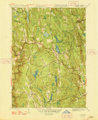
1948 Map of Goshen
USGS Topo · Published 1948About this map
The hills of Goshen and Chesterfield dominate this mid-century landscape, defined by a complex network of brooks and small ponds draining toward the Westfield River and the North Branch Swift River. This post-war survey illustrates the area just as the Berkshire Trail was becoming a vital automotive artery through Western Massachusetts. The map reveals a mix of recreational and historic land use, from the Daughters of the American Revolution State Forest and its Highland Lakes to the youth facilities at Camp Howe. Local genealogists will find the locations of Goshen Cem and The Mount Cem useful for tracing early family lineages in this Hampshire County township. Small settlements like Lithia and the seasonal retreat of Mountain Rest appear along the Stage Road, marking the quiet transition from old hill-town farming to a modern mountain-corridor economy.
Find a feature on this map
79 named features on this map. Tap any name to fly to it.
Don’t see what you’re looking for? This feature index may not catch every label — zoom into the map to look around manually.
Map Details
Editions of this 1948 Goshen Map
2 editions found
Other maps of this area

1885 · Northampton
USGS Topo · 1:62,500

1886 · Hawley
USGS Topo · 1:62,500

1886 · Chesterfield
USGS Topo · 1:62,500

1886 · Northampton
USGS Topo · 1:62,500

1888 · Chesterfield
USGS Topo · 1:62,500

1890 · Hawley
USGS Topo · 1:62,500

1890 · Greenfield
USGS Topo · 1:62,500

1891 · Northampton
USGS Topo · 1:62,500

1893 · Northampton
USGS Topo · 1:62,500

1893 · Chesterfield
USGS Topo · 1:62,500