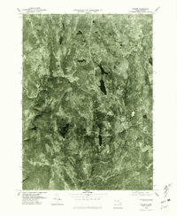
1975 Map of Goshen
USGS Topo · Published 1981About this map
Goshen and the surrounding Hampshire County hills are captured here in a 1975 orthophotoquad, which uses aerial imagery to reveal the density of the Massachusetts forest and the precise clearing of its settlements. The small village of Lithia and the community of Swift River sit along the winding watercourse of the Swift River, which cuts through the northwest corner of the map. To the south, the settlement of Chesterfield occupies the higher ground above the Westfield River. This type of imagery provides an unfiltered view of the 1970s landscape, showing how the roads and property lines followed the natural contours of the land. Large water bodies like the Highland Lakes and Hammond Pond stand out as dark, sharp contrasts against the textured canopy of the Berkshire foothills, marking significant local landmarks for those studying the area's geography and residential development.
Find a feature on this map
8 named features on this map. Tap any name to fly to it.
Don’t see what you’re looking for? This feature index may not catch every label — zoom into the map to look around manually.
Map Details
Editions of this 1975 Goshen Map
This is the sole edition of this map. No revisions or reprints were ever made.
Other maps of this area

1885 · Northampton
USGS Topo · 1:62,500

1886 · Hawley
USGS Topo · 1:62,500

1886 · Chesterfield
USGS Topo · 1:62,500

1886 · Northampton
USGS Topo · 1:62,500

1888 · Chesterfield
USGS Topo · 1:62,500

1890 · Hawley
USGS Topo · 1:62,500

1890 · Greenfield
USGS Topo · 1:62,500

1891 · Northampton
USGS Topo · 1:62,500

1893 · Northampton
USGS Topo · 1:62,500

1893 · Chesterfield
USGS Topo · 1:62,500