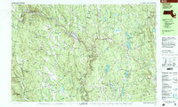
1997 Map of Goshen
USGS Topo · Published 1999About this map
The Westfield River carves a deep valley through this portion of the Berkshire foothills, anchoring the settlements of Cummington and West Chesterfield. In the late 20th century, this landscape was defined by its extensive protected lands, including the Daughters of the American Revolution State Forest and the Gilbert A Bliss State Forest. These public lands sit alongside established community fixtures like the Cummington Fairgrounds and Camp Holy Cross on the shores of Upper Highland Lake. Local history is preserved in small hill-town centers like Goshen and Worthington Corners, where civic life revolves around the Davenport Sch and several historic burying grounds, including Bryant Cem and Dawes Cem. The map reveals a transition from the river-bottom industry and transport of the valley to the higher, recreational terrain of Bryant Mountain and Deer Hill.
Find a feature on this map
125 named features on this map. Tap any name to fly to it.
Don’t see what you’re looking for? This feature index may not catch every label — zoom into the map to look around manually.
Map Details
Editions of this 1997 Goshen Map
This is the sole edition of this map. No revisions or reprints were ever made.
Other maps of this area

1885 · Northampton
USGS Topo · 1:62,500

1886 · Greylock
USGS Topo · 1:62,500

1886 · Hawley
USGS Topo · 1:62,500

1886 · Chesterfield
USGS Topo · 1:62,500

1886 · Northampton
USGS Topo · 1:62,500

1886 · Becket
USGS Topo · 1:62,500

1888 · Becket
USGS Topo · 1:62,500

1888 · Chesterfield
USGS Topo · 1:62,500

1890 · Hawley
USGS Topo · 1:62,500

1890 · Greenfield
USGS Topo · 1:62,500