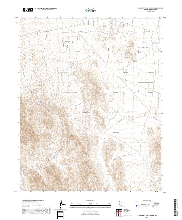
2023 Map of Grasshopper Junction NW
USGS Topo · Published 2023About this map
Black Mountains terrain dominates the central and western reaches of this Mohave County quadrangle, where the arid landscape drops sharply into the Detrital Valley. The mapping of the Mojave Desert here reveals a sparse network of modern residential roads like Cheryl Ave and Montere Ave that contrast with the ancient natural drainage systems. Water sources are critical identifiers in this environment, with the Cottonwood Reservoir and Middle Tank providing man-made intervention in a terrain defined by seasonal flows. Evidence of early habitation or prospecting remains in the naming of Lost Cabin Spring, which feeds into the Lost Cabin Wash. This survey provides a precise accounting of the intersection between established desert infrastructure and the prominent washes, including Portland Wash and Detrital Wash, which channel runoff through the valley floor.
Find a feature on this map
39 named features on this map. Tap any name to fly to it.
Don’t see what you’re looking for? This feature index may not catch every label — zoom into the map to look around manually.
Map Details
Editions of this 2023 Grasshopper Junction NW Map
This is the sole edition of this map. No revisions or reprints were ever made.
Other maps of this area

1886 · Camp Mohave
USGS Topo · 1:250,000

1892 · Camp Mohave
USGS Topo · 1:250,000

1926 · Nelson
USGS Topo · 1:96,000

1926 · Mohave City
USGS Topo · 1:96,000

1942 · Camp Mohave
USGS Topo · 1:250,000

1947 · Kingman
USGS Topo · 1:250,000

1948 · Kingman
USGS Topo · 1:250,000

1954 · Kingman
USGS Topo · 1:250,000

1955 · Kingman
USGS Topo · 1:250,000

1958 · Kingman
USGS Topo · 1:250,000