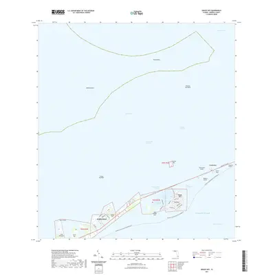
2021 Map of Grassy Key
USGS Topo · Published 2021About this map
The Middle Keys of Monroe County are depicted in their modern configuration, showcasing the sequence of islands and bridges that link the Florida Bay and the Atlantic Ocean. Residential development and resort infrastructure are concentrated along the Overseas Highway corridor in Marathon, Grassy Key, and Duck Key, where street names like Indies Dr N and Harbour Dr indicate a maritime-focused community. The map illustrates the sophisticated engineering of the Florida Keys, including the Long Key Viaduct and the managed water flow through Toms Harbor Cut.
Find a feature on this map
44 named features on this map. Tap any name to fly to it.
Don’t see what you’re looking for? This feature index may not catch every label — zoom into the map to look around manually.
Map Details
Editions of this 2021 Grassy Key Map
This is the sole edition of this map. No revisions or reprints were ever made.
Other maps of this area

1971 · Grassy Key
USGS Topo · 1:24,000

1971 · Marathon
USGS Topo · 1:24,000

1971 · Long Key
USGS Topo · 1:24,000

1971 · Crawl Key
USGS Topo · 1:24,000

1972 · Marathon
USGS Topo · 1:24,000

1972 · Bamboo Key
USGS Topo · 1:24,000

1972 · Schooner Bank
USGS Topo · 1:24,000

1972 · East Bahia Honda Key NE
USGS Topo · 1:24,000

1972 · Buchanan Keys
USGS Topo · 1:24,000

1983 · Islamorada
USGS Topo · 1:100,000