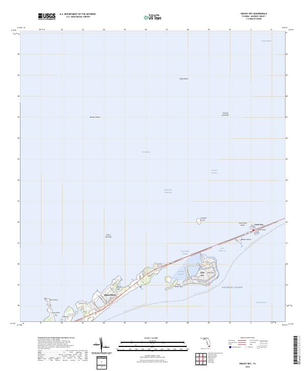
2024 Map of Grassy Key
USGS Topo · Published 2024About this map
Marathon and the surrounding Middle Keys are depicted in this recent survey, capturing the modern infrastructure and protected waters of the Florida archipelago. The landscape is defined by the narrow corridor of the Florida Keys Overseas Heritage Trl and various local routes like Indies Dr N and W Seaview Dr that serve residential developments on Duck Key. The map reveals the intricate water passages critical to the region, including the Intracoastal Waterway, Toms Harbor Cut, and the Duck Key Channel, which separate the various keys and banks.
Find a feature on this map
42 named features on this map. Tap any name to fly to it.
Don’t see what you’re looking for? This feature index may not catch every label — zoom into the map to look around manually.
Map Details
Editions of this 2024 Grassy Key Map
This is the sole edition of this map. No revisions or reprints were ever made.
Other maps of this area

1971 · Grassy Key
USGS Topo · 1:24,000

1971 · Marathon
USGS Topo · 1:24,000

1971 · Long Key
USGS Topo · 1:24,000

1971 · Crawl Key
USGS Topo · 1:24,000

1972 · Marathon
USGS Topo · 1:24,000

1972 · Bamboo Key
USGS Topo · 1:24,000

1972 · Schooner Bank
USGS Topo · 1:24,000

1972 · East Bahia Honda Key NE
USGS Topo · 1:24,000

1972 · Buchanan Keys
USGS Topo · 1:24,000

1983 · Islamorada
USGS Topo · 1:100,000