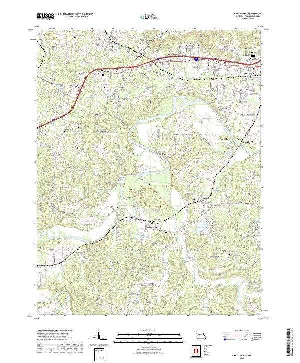
2021 Map of Gray Summit
USGS Topo · Published 2021About this map
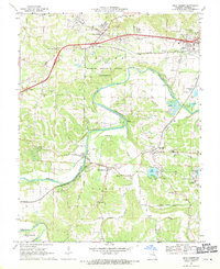
The Meramec River winds through this section of Franklin County, defining a landscape shaped by both the river valley and the overland routes of the Pacific area. Modern development and legacy family landmarks sit side-by-side, notably in the dense cluster of cemeteries near the eastern edge, such as Old Saint Bridgets Cem and New Saint Bridgets Cem. The map documents a transition from the historic railroad-centered town of Catawissa and the crossroads at Gray Summit to the residential growth spreading from the Meramec's banks.
Find a feature on this map
176 named features on this map. Tap any name to fly to it.
Don’t see what you’re looking for? This feature index may not catch every label — zoom into the map to look around manually.
Map Details
Editions of this 2021 Gray Summit Map
This is the sole edition of this map. No revisions or reprints were ever made.