Old Maps of Franklin County, Missouri
Explore 176 old maps of Franklin County, spanning from 1890 to today. These high-resolution historic maps reveal how streets, neighborhoods, landmarks, and natural features evolved over time — perfect for genealogy, metal detecting, research, and local history exploration.
What you can do with these maps:
- See how Franklin County changed over time: Compare historical maps to modern-day views to trace roads, homesites, rail lines & more.
- View detailed metadata: Each map includes creators, publishers, year, scale, and archive source.
- Overlay maps with satellite & LiDAR: Visualize the past alongside modern tools to explore terrain & human change.
- Trusted historical sources: Maps sourced from the USGS, Library of Congress, and other archives.
- Access maps your way: View online, download high-res files, or order prints for personal or research use.
Start exploring old maps of Franklin County to uncover forgotten places, hidden landmarks, and the deep history beneath your feet.
Franklin County, MO maps
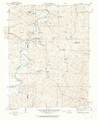
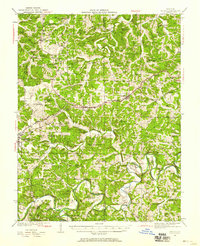
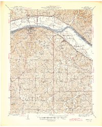
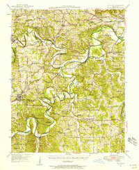
(176)- 1890 Map of Hermann
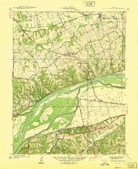
 1890 Hermann1890 Print · USGSMid-Missouri river life and rail commerce define this late-century landscape during a period of steady expansion. Genealogists and historians can trace family roots through old post offices like Hopewell Academy P.O. and Swiss P.O. or the early street grids of Hermann and Warrenton.5 unique versions available
 - 1901 Map of De Soto
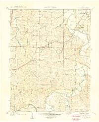
 1901 De Soto1901 Print · USGSJefferson and Franklin Counties at the turn of the century show a landscape defined by industrial milling and river fords. Genealogists can trace early homesteads near Hillsboro or industrial sites like Vulcan Mine and Byrnes Mill.5 unique versions available
 - 1903 Map of O'Fallon
 1903 O'Fallon1903 Print · USGSSt. Charles County at the turn of the century is a labyrinth of river islands and rail lines at the confluence of the Missouri and Mississippi. Researchers can trace old river landings like Cap Au Gris Landing and family-named settlements from Moscow Mills to New Melle.5 unique versions available
 - 1903 Map of Sullivan
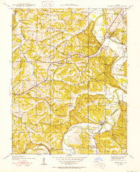
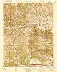
 1903 Sullivan1903 Print · USGSFranklin and Gasconade counties are captured here at the close of the nineteenth century, as the St. Louis and San Francisco railroad spurred growth in timber and mining. Genealogists can trace early homesteads and river crossings like Hughes Ford, Spring Bluff, and Anthonies Mill.3 unique versions available
 - 1934 Map of Meramec State Park, 1962 Print
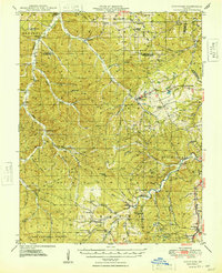
 1934 Meramec State Park1962 Print · USGSThe Meramec River valley in the mid-1930s reveals a region transitioning from isolated settlements to a destination for early 20th-century tourism. Genealogists and historians can trace defunct school districts like Pea Ridge Sch and Zion Sch, locate the CCC Camp, or find old river crossings at Hamilton Ford.2 unique versions available
 - 1935 Map of Gerald
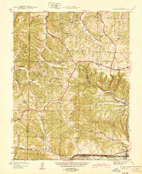
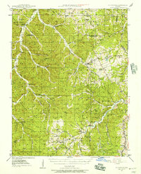
 1935 Gerald1935 Print · USGSThe borderlands of Gasconade and Franklin counties are seen here in the mid-1930s as the Chicago Rock Island and Pacific railroad connects growing towns like Gerald and Rosebud. Local historians can trace dozens of rural school sites, including Buffalo Ridge School and Hinton Sch, alongside family-named landmarks and the meandering Bourbeuse River.
 - 1936 Map of Hermann
 1936 Hermann1936 Print · USGSThe riverfront at Hermann and the surrounding hill country are captured here in the mid-1930s. Genealogists can trace family roots through an extensive network of rural landmarks, from the Swiss Sch and St Josephs Ch to the small settlement of Detmold.
 - 1937 Map of Pacific
 1937 Pacific1937 Print · USGSIn the late 1930s, the Meramec and Big River valleys formed a landscape of rail junctions and rural infirmaries. You can trace the rail lines at Pacific, locate the C C C Camp, or find local schools like McNamee Sch and La Barque Sch.4 unique versions available
 - 1937 Map of Weldon Spring
 1937 Weldon Spring1937 Print · USGSThe Missouri River bottoms and the rising hills of St. Charles County are shown here in the late thirties, just as industrial and parkland developments began to reshape the region. Genealogists can locate several family burial grounds like Wolf Cem and Howell Cem, alongside rural centers such as Centaur Station and Toonerville.
 - 1937 Map of Meramec State Park
 1937 Meramec State Park1937 Print · USGSThe Missouri Ozarks are captured here in the mid-1930s, showing the early infrastructure of Meramec State Park and its surrounding river communities. Genealogists and hikers can trace old homesteads and local landmarks like Reedville Ch, the CCC Camp, and the historic Sappington Bridge river crossing.
 - 1938 Map of Cedar Hill
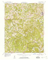
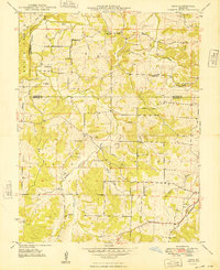
 1938 Cedar Hill1938 Print · USGSJefferson County before the Second World War was a network of river-bottom mills and ridge-top schools connected by winding country roads. Genealogists can trace family footprints at Morse Mill, the MCCULLOCH FORD crossing, and rural schools like Bethlehem Sch.2 unique versions available
 - 1940 Map of Cedar Hill
 1940 Cedar Hill1940 Print · USGSJefferson County was a landscape of small river towns and hilltop schoolhouses just before the 1940s. Genealogists and local historians can trace family roots through landmarks like St Martins Ch, Morse Mill, and the many rural schools including Bethlehem Sch.
 - 1940 Map of Eureka
 1940 Eureka1940 Print · USGSThe Missouri countryside west of St. Louis appears here just before the mid-century, defined by the twin river valleys of the Missouri and Meramec. You can trace the development of Eureka and Allenton along the St Louis San Francisco rail line, or find the CCC Camp and Wildhorse Creek Sch in the hills.
 - 1940 Map of Weldon Spring
 1940 Weldon Spring1940 Print · USGSThe Missouri River bottoms and St. Charles County uplands are captured here just before the Second World War. Researchers can trace family history through several rural landmarks, including Pitman Cem, Antioch Ch, and the lost river community of Hamburg.
 - 1941 Map of Gerald, 1958 Print
 1941 Gerald1958 Print · USGSFranklin and Gasconade counties are documented here in the early 1940s, highlighting a landscape defined by small-town rail stops and rural school districts. Genealogists can locate family landmarks such as St Paul Cem, Japan Sch, and the settlement of Champion City.
 - 1942 Map of Hermann, 1961 Print
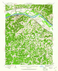 1942 Hermann1961 Print · USGSMid-Missouri river life and rail commerce are documented here during the early 1940s as the river winds past thriving valley towns. Researchers can trace historic farmsteads, family burial grounds like Meyers Cem, and numerous rural schoolhouses such as Peace Hill Sch and Swiss Sch.2 unique versions available
 - 1944 Map of Eureka
 1944 Eureka1944 Print · USGSSouthwest St. Louis County remains a landscape of creek-bottom farms and wooded ridges during the early 1940s. Genealogists can trace family roots through sites like Bethany Ch, Melrose Sch, and the old rail stops at Glencoe and Allenton.3 unique versions available
 - 1944 Map of Gerald
 1944 Gerald1944 Print · USGSGerald and the surrounding Gasconade County hills are shown here just after the start of the 1940s as the rail-and-river economy shaped local life. Genealogists can trace a network of rural schools and churches, including Drake Ch, Tea Sch, and Champion City.2 unique versions available
 - 1945 Map of Hermann
 1945 Hermann1945 Print · USGSThe Missouri River valley near Hermann and Berger is shown here in the mid-1940s, documenting a landscape of river-and-rail transport. Genealogists can trace family names through rural landmarks like St Johns Ch, Roth Cem, and Frene Sch.2 unique versions available
 - 1946 Map of Richwoods, 1957 Print
 1946 Richwoods1957 Print · USGSThe Missouri Ozarks are captured here at the end of the Second World War, showing the rural communities of Washington County. Genealogists can locate family-named landmarks and institutions like Old Mines, Souls Chapel, and the Ebo Sch schoolhouse.3 unique versions available
 - 1946 Map of Union, 1958 Print
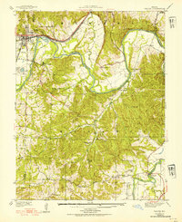
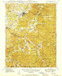
 1946 Union1958 Print · USGSFranklin County just after the war shows a landscape of river-valley settlements and rural school districts. Genealogists and researchers can trace family landmarks like Moser Mill, locate the Old Acid Mine, or find early sites such as Benson Tourist City and Morrellton PO.2 unique versions available
 - 1947 Map of Sullivan
 1947 Sullivan1947 Print · USGSIn the Missouri Ozarks during the late 1940s, this area shows the growth of river tourism and the railroad corridor. You can trace family roots through numerous local landmarks like Anthonies Mill, Pea Ridge Sch, and Reeds Defeat Cem.3 unique versions available
 - 1947 Map of St. Clair, 1950 Print
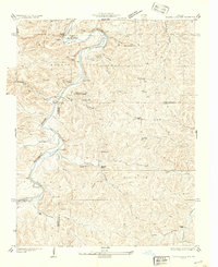
 1947 St. Clair1950 Print · USGSFranklin County at the dawn of the fifties shows a landscape shaped by the winding Meramec River and a busy network of major railroads. Genealogists and local historians can locate early landmarks like Purina Farm, the Virginia Mines (Abandoned), and the Brush Creek Cem.3 unique versions available
 - 1948 Map of Argo
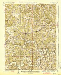
 1948 Argo1948 Print · USGSCrawford and Franklin Counties appear here in the late 1940s, showing a rural landscape of ridge-top farms and river valleys. Genealogists can locate family landmarks like Martin Cemetery and Helms Cemetery or old schools such as Argo School and Delhi School.4 unique versions available
 - 1948 Map of Richwoods
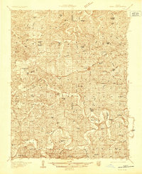
 1948 Richwoods1948 Print · USGSIn the mid-1940s, this area of Washington County remained a landscape of rural schoolhouses and family-named hollows. Researchers can trace the layout of early communities like Richwoods, locate the historic Souls Chapel, or find remote school sites such as Hulsey Sch and Clifton Sch.
Showing maps 1-25 of 176
Top cities of Franklin County
- Washington historical maps
- Union historical maps
- Pacific historical maps
- Gray Summit historical maps
- New Haven historical maps
- Gerald historical maps
See more
Frequently asked questions
- What are the different types of historical maps available for Franklin County?
- What is the oldest map of Franklin County?
- Where can I purchase historical maps of Franklin County for my home or office?
- Where can I download high-res historical maps of Franklin County?
- Are there historical topographic maps available for Franklin County?
- Is there historical aerial imagery available for Franklin County?
- Where are historical maps of Franklin County sourced from?