2020s Maps of Franklin County, Missouri
Explore 26 historic maps of Franklin County from the 2020s. These maps offer a rare glimpse into what life looked like during the 2020s — showing old roads, neighborhoods, homes, and landmarks that have changed or disappeared over time.
Whether you're researching your family's past, planning a metal detecting trip, or studying how Franklin County's landscape evolved across the 2020s, these high-resolution maps are a powerful tool for exploring the history of this region.
- Focus on a specific era: All maps on this page are from the 2020s, giving you a focused view of this time period.
- See what’s changed: Compare century-old streets, trails, and buildings to today's modern landscape using overlays and satellite layers.
- Research with precision: Use these maps for genealogy, historical research, land use analysis, or educational projects.
- View, download, or print: Maps are fully viewable online in high resolution, and can be downloaded or printed for your own records.
Start exploring Franklin County's history through authentic maps from the 2020s. This is your window into the past.
Franklin County, MO maps
(26)- 2021 Map of Cyclone Hollow, 2021 Print
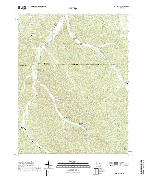 2021 Cyclone Hollow2021 Print · USGSWashington and Franklin counties appear here in the modern era, showing a landscape defined by the ridges and hollows of the eastern Ozarks. Researchers can trace local history through family-named sites like Granddaddy Hollow and historic burials at New Chapel Hill Cem or Arnold Cem.
 - 2021 Map of Saint Clair, 2021 Print
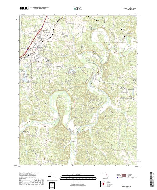 2021 Saint Clair2021 Print · USGSFranklin County settlement patterns come to life in this recent survey of the Missouri landscape. Genealogists can trace family burial sites at Bethel Baptist Church Cem and Fisher Cem, or locate landmarks like Plum Ford and St. Clair.
 - 2021 Map of Richwoods, 2021 Print
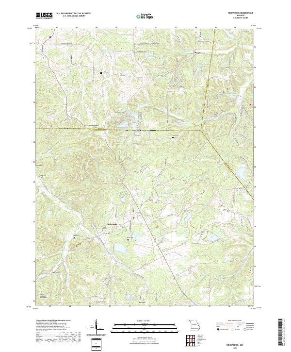 2021 Richwoods2021 Print · USGSRichwoods and the northern Saint Francois Mountains appear in detail during the early 2020s. Genealogists and local historians can locate numerous family burial sites such as Sparks Cem, Asplin Cem, and Horine Cem near settlements like Maupin.
 - 2021 Map of Eureka, 2021 Print
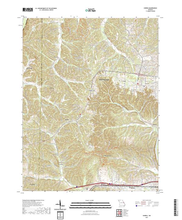 2021 Eureka2021 Print · USGSThe suburbs and wooded ridges west of St. Louis are shown here in the modern era as they balance residential growth with local heritage. Researchers can trace the BNSF Railway corridor through Eureka or locate family sites near Allen Cem and Glencoe.
 - 2021 Map of Washington East, 2021 Print
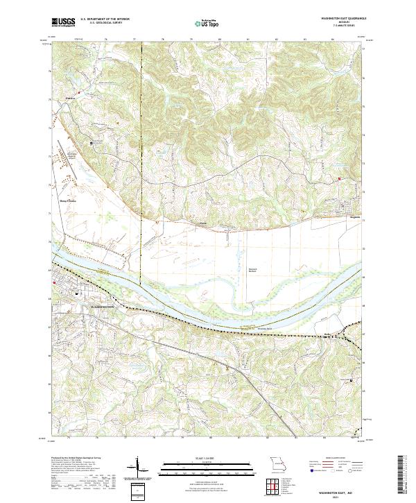 2021 Washington East2021 Print · USGSThe Missouri River valley near Augusta and Washington is captured here in the early twenty-first century. Genealogists and local historians can trace family-named sites like Saint Vincent de Paul Cem, the old settlement at Nona, and the riverside path of the Katy Trl.
 - 2021 Map of Cedar Hill, 2021 Print
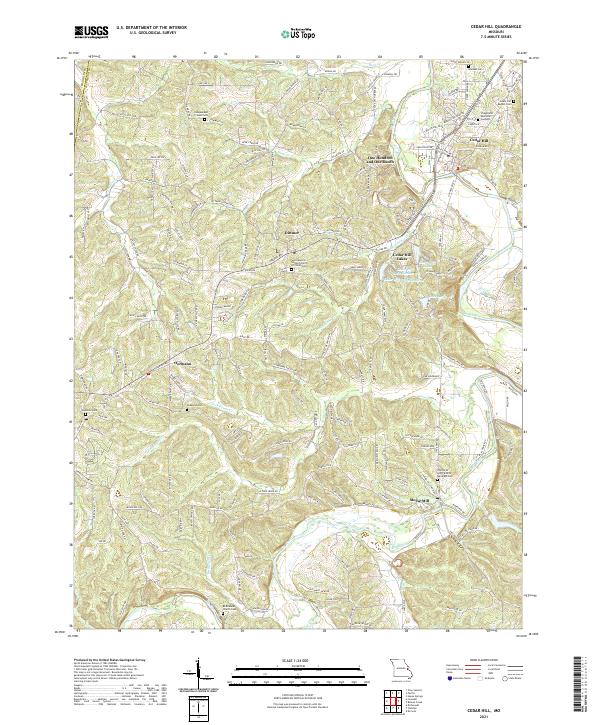 2021 Cedar Hill2021 Print · USGSJefferson County hill country and the Big River valley are shown here in recent years, highlighting a landscape of deep-rooted rural communities. Researchers can trace family history at the Wideman Cem, Bethlehem Church Cem, or the namesake settlement of Morse Mill.
 - 2021 Map of Weldon Spring, 2021 Print
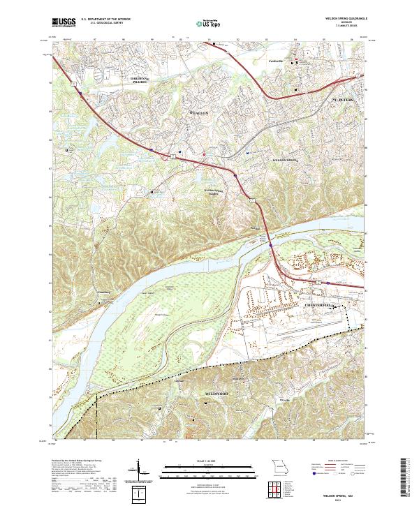 2021 Weldon Spring2021 Print · USGSGreater St. Louis was undergoing significant suburban growth and infrastructure modernization in the early 2020s. Researchers can locate numerous family burial sites such as Francis Howell Cem and trace the Missouri River shoreline past Howell Island.
 - 2021 Map of Gray Summit, 2021 Print
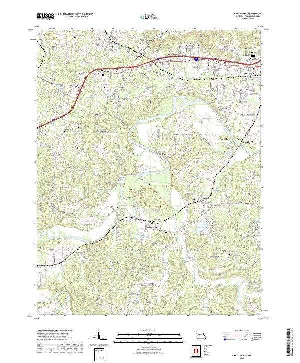 2021 Gray Summit2021 Print · USGSFranklin County in the early 2020s shows a landscape of river-bend settlements and deep-rooted family history. Genealogists can trace local lineages through Old Saint Bridgets Cem, Shiloh Cem, and Thompson Cem near the Meramec River.
 - 2021 Map of Labadie, 2021 Print
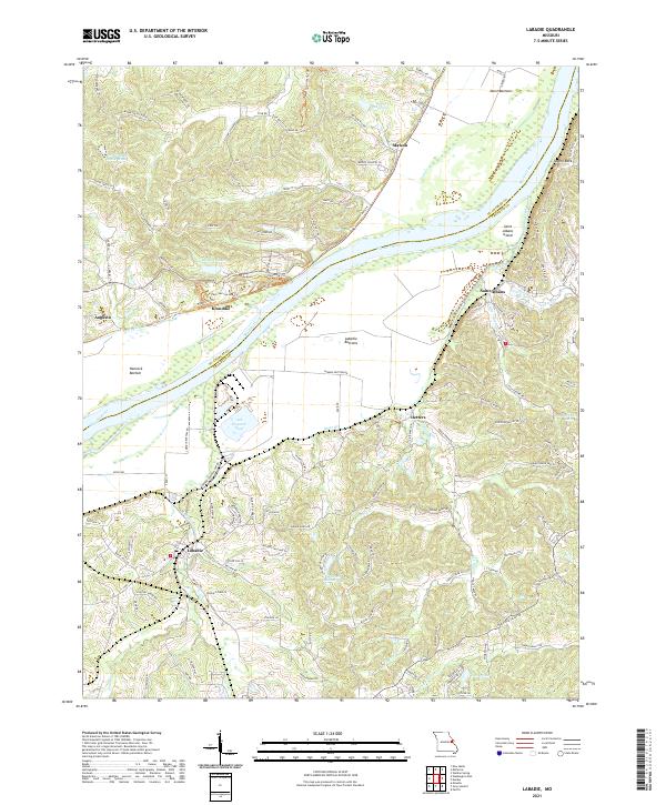 2021 Labadie2021 Print · USGSThe Missouri River valley in the early 2020s shows a unique transition from industrial sites to quiet riverside communities. Trace the topography of the river bluffs near Labadie, explore the trails around Klondike, or locate family-named features like Matson and Saint Albans.
 - 2021 Map of Stanton, 2021 Print
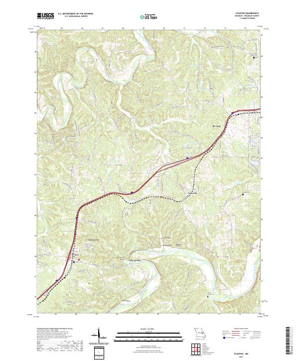 2021 Stanton2021 Print · USGSFranklin County's river valleys and interstate corridors are captured in this recent survey. Local researchers can trace family landmarks and burial sites including Stanton Cem, Kamper Cem, and the quiet rural community of Twin Springs.
 - 2021 Map of Moselle, 2021 Print
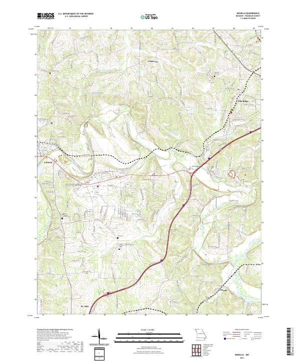 2021 Moselle2021 Print · USGSFranklin County communities like Villa Ridge and Gildehouse are captured in this recent survey of Missouri's river country. Researchers can trace local heritage through several family and community landmarks, including Indian Prairie Cem, Bethlehem Ch, and East Central College.
 - 2021 Map of Treloar, 2021 Print
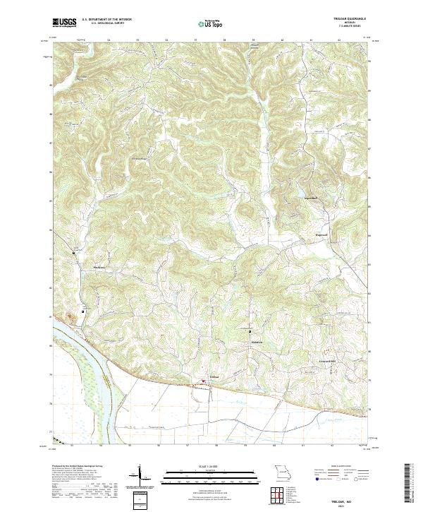 2021 Treloar2021 Print · USGSWarren County's riverfront and rolling ridges are documented here during the early 2020s, showing the enduring rural character near the Missouri River. Local historians can trace old homestead locations near Holstein and Treloar, or locate family sites at Saint Johns Cem and Immanuels Cem.
 - 2021 Map of Sullivan, 2021 Print
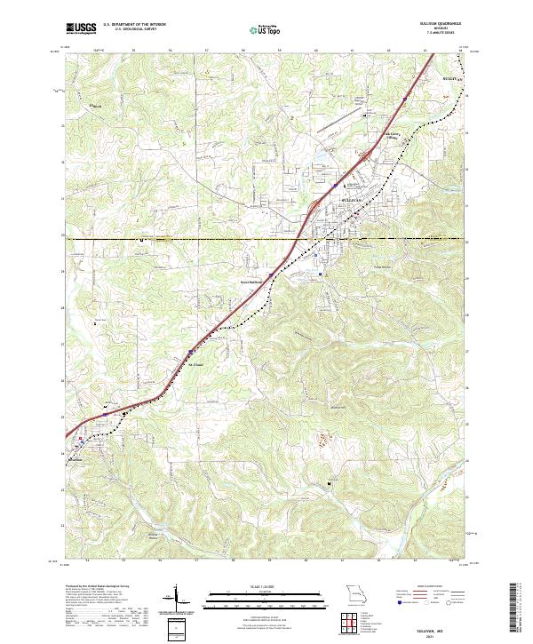 2021 Sullivan2021 Print · USGSSullivan and the surrounding Missouri countryside appear in this modern survey during a period of steady growth along the BNSF Railway. Researchers can trace family history through numerous burial grounds like Turner Cemetery and Hill Cemetery, or explore the terrain near Bluff Lake.
 - 2021 Map of Strain, 2021 Print
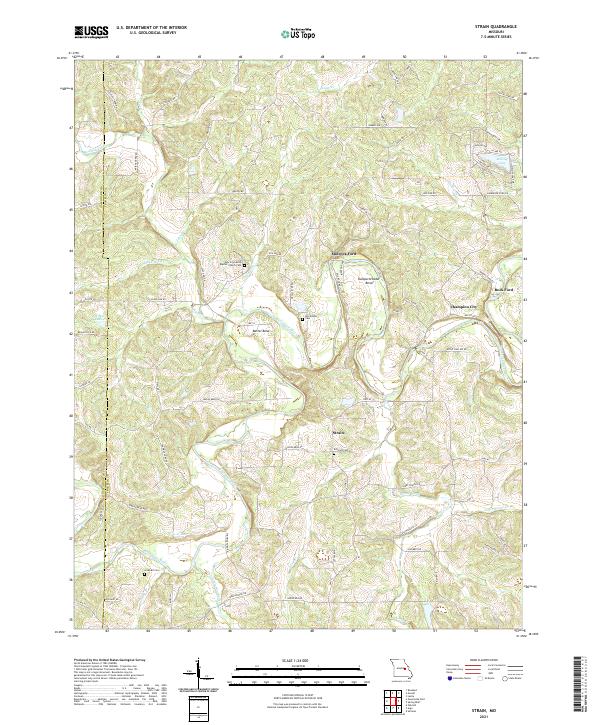 2021 Strain2021 Print · USGSThe Bourbeuse River valley in Franklin County remains a rural landscape defined by its historic river crossings and small settlements. Genealogists can locate several family burial sites, including Lockhart Cem and McCallister Cem, alongside the community at Strain.
 - 2021 Map of New Haven, 2021 Print
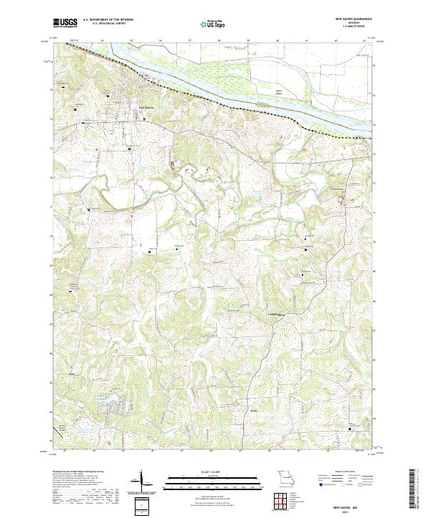 2021 New Haven2021 Print · USGSFranklin County's riverfront and rolling interior are captured in this recent survey of the Missouri River valley. Genealogists and local historians can trace the rural landscape between New Haven and Kiel, identifying numerous family burial sites like Kasel Cem and landmarks such as Enoch Knob.
 - 2021 Map of Leslie, 2021 Print
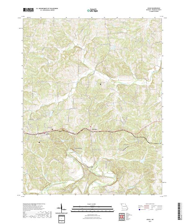 2021 Leslie2021 Print · USGSFranklin County's rural landscape is captured here in the early 2020s, centered on the Bourbeuse River. Genealogists and local historians can trace family locations near Noser Mill, Greenstreet, and the historic Leslie United Methodist Cem.
 - 2021 Map of Pacific, 2021 Print
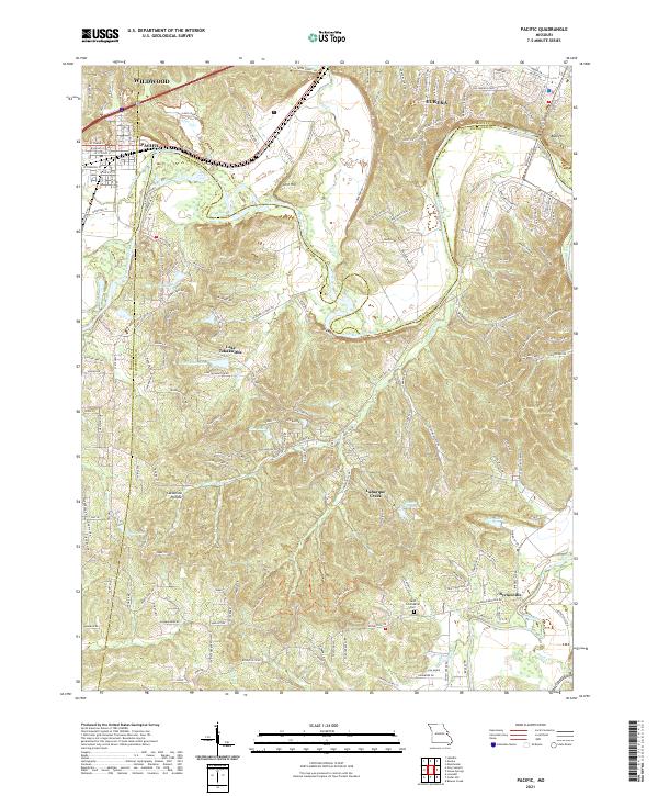 2021 Pacific2021 Print · USGSPacific and Eureka sit at a unique geographic crossroads where three counties meet along the winding Meramec River. Genealogists and local historians can trace family-named sites like Saint Columbkille Cem and the McNamee School Rd.
 - 2021 Map of Union, 2021 Print
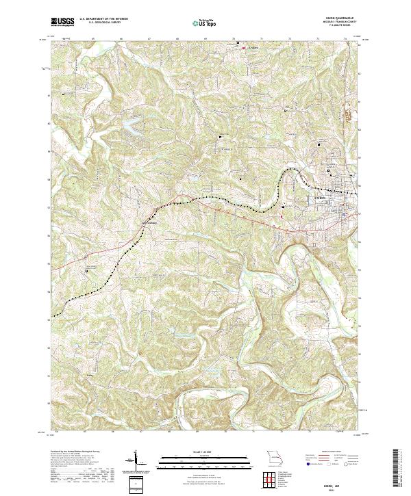 2021 Union2021 Print · USGSFranklin County's heartland is captured here in the early twenty-first century, showing the established city of UNION and its surrounding farm communities. Researchers can trace ancestral connections through numerous local burial sites like Saint Jordans Church Cem and Meyer Cem, or follow the course of the Bourbeuse River.
 - 2021 Map of Berger, 2021 Print
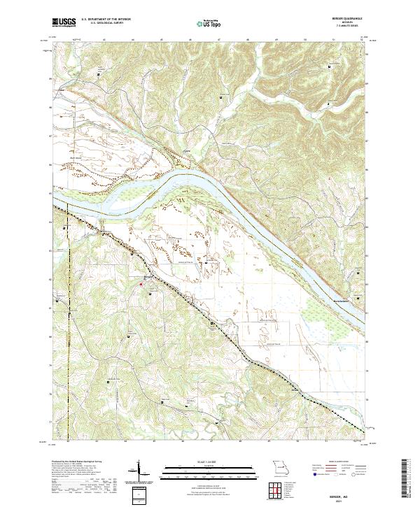 2021 Berger2021 Print · USGSThe river bluffs of Franklin County come into sharp focus in this recent survey of Berger and the winding Missouri River valley. Genealogists and local historians can trace family land and burial sites at Saint Pauls Cem, Finks Cem, and Etlah.
 - 2021 Map of Meramec State Park, 2021 Print
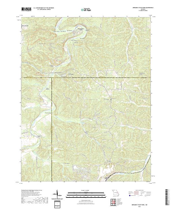 2021 Meramec State Park2021 Print · USGSThe Meramec River corridor and the ridges of the Ozarks are captured here during the early 2020s. Researchers can locate family landmarks like Pea Ridge Cem, the settlement of Caseyville, and historic river crossings at Sappington Bridge.
 - 2021 Map of Washington West, 2021 Print
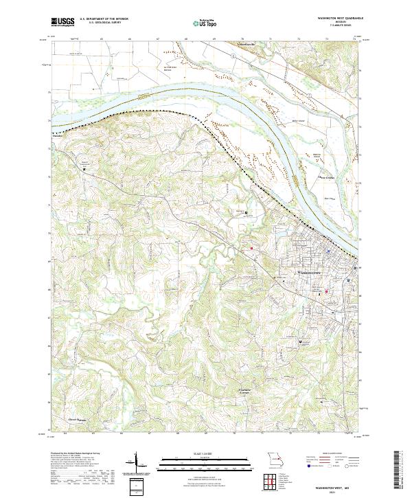 2021 Washington West2021 Print · USGSFranklin and Warren Counties are captured here along the Missouri River in 2021, showing the modern layout of the river valley. Researchers can trace local heritage through sites like Saint Francis Borgia Catholic Cem or explore the rural surroundings of Clover Bottom and Marthasville.
 - 2021 Map of Spring Bluff, 2021 Print
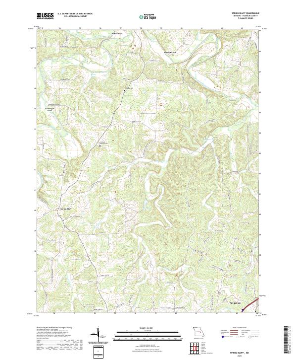 2021 Spring Bluff2021 Print · USGSFranklin County's rural heartland is documented here in the early twenty-first century, showing a landscape defined by the Bourbeuse River and its historic fords. Researchers can locate family landmarks like Evergreen Cem or trace the routes to Peters Ford and Spring Bluff.
 - 2021 Map of Dissen, 2021 Print
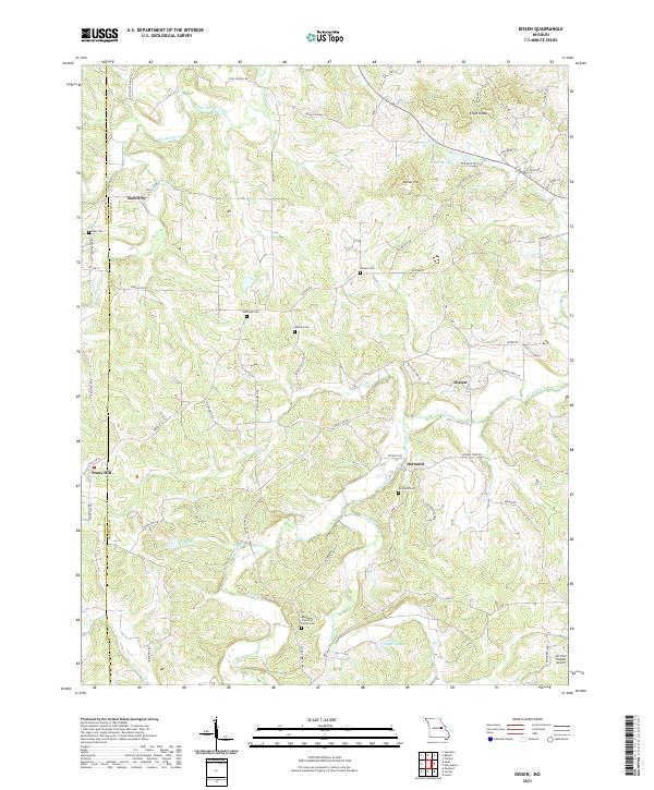 2021 Dissen2021 Print · USGSFranklin and Gasconade counties are documented here in the early 2020s, showing the enduring rural character of central Missouri. Genealogists can locate family burial sites like Detmold Cem and Meyers Cem or trace the settlements of Kohl City and Dissen.
 - 2021 Map of Argo, 2021 Print
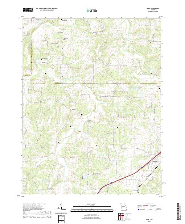 2021 Argo2021 Print · USGSThe rural borderlands of Crawford and Franklin counties are captured here in the early twenty-first century. Genealogists can trace family lines through numerous sites like Old Japan Cem, Walker Cem, and the settlements of Japan and Argo.
 - 2021 Map of Gerald, 2021 Print
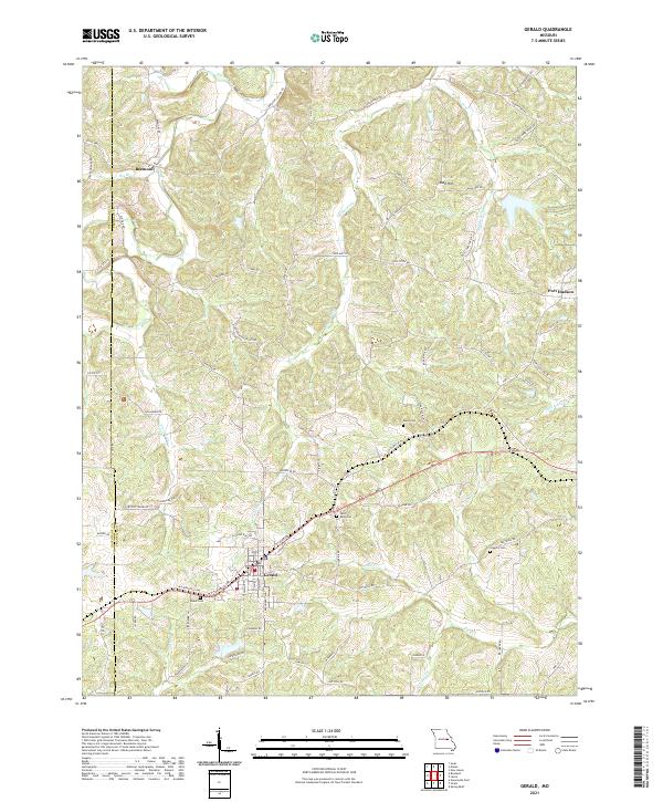 2021 Gerald2021 Print · USGSThe Franklin and Gasconade County line area comes into focus here during the early twenty-first century. Researchers can trace rural lineages through numerous local sites like Boeuf Cem and the small settlements of Beemont and Port Hudson.
Showing maps 1-25 of 26
Top cities of Franklin County
- Washington historical maps
- Union historical maps
- Pacific historical maps
- Gray Summit historical maps
- New Haven historical maps
- Gerald historical maps
See more
Frequently asked questions
- What are the different types of historical maps available for Franklin County?
- What is the oldest map of Franklin County?
- Where can I purchase historical maps of Franklin County for my home or office?
- Where can I download high-res historical maps of Franklin County?
- Are there historical topographic maps available for Franklin County?
- Is there historical aerial imagery available for Franklin County?
- Where are historical maps of Franklin County sourced from?