1980s Maps of Franklin County, Missouri
Explore 10 historic maps of Franklin County from the 1980s. These maps offer a rare glimpse into what life looked like during the 1980s — showing old roads, neighborhoods, homes, and landmarks that have changed or disappeared over time.
Whether you're researching your family's past, planning a metal detecting trip, or studying how Franklin County's landscape evolved across the 1980s, these high-resolution maps are a powerful tool for exploring the history of this region.
- Focus on a specific era: All maps on this page are from the 1980s, giving you a focused view of this time period.
- See what’s changed: Compare century-old streets, trails, and buildings to today's modern landscape using overlays and satellite layers.
- Research with precision: Use these maps for genealogy, historical research, land use analysis, or educational projects.
- View, download, or print: Maps are fully viewable online in high resolution, and can be downloaded or printed for your own records.
Start exploring Franklin County's history through authentic maps from the 1980s. This is your window into the past.
Franklin County, MO maps
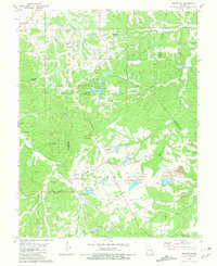
(10)- 1980 Map of Stanton, 1982 Print
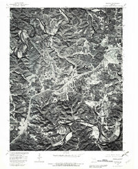 1980 Stanton1982 Print · USGSThe Meramec and Bourbeuse river valleys are captured in photographic detail during the early 1980s. Local researchers can trace the development of Stanton and Anaconda, or study the rural landscape around Twin Springs.
 - 1980 Map of Moselle, 1982 Print
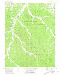
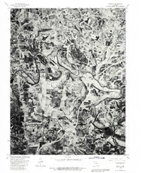 1980 Moselle1982 Print · USGSFranklin County's rolling river valleys and agricultural plateaus are captured in detail during the early 1980s. Researchers can trace the meandering Bourbeuse River and locate family lands near Moselle, Villa Ridge, and Gildehouse.
 - 1980 Map of Union, 1982 Print
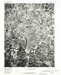
 1980 Union1982 Print · USGSFranklin County's rural landscape is captured during the early eighties, showing the agricultural patterns surrounding Union. Researchers can trace the meandering Bourbeuse River or locate family sites near Krakow and Jefferiesburg.
 - 1980 Map of St. Clair, 1982 Print
 1980 St. Clair1982 Print · USGSSt. Clair and the winding Meramec River valley are captured in this 1980 aerial survey just as the town began to expand. Genealogists and local historians can trace the development of St Clair, the rural lots near Piney Park, and the path of the Fifth Principal Meridian.
 - 1981 Map of Richwoods
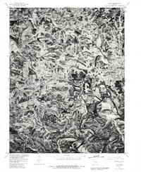
 1981 Richwoods1981 Print · USGSRichwoods and the tri-county border area come alive in this early 1980s survey, showing the deep integration of mining and rural life. Researchers can trace family roots at St Stephens Cem, explore the extensive Richwoods Tailings Ponds, or locate the Joan Lake Landing Strip.
 - 1981 Map of Cyclone Hollow
 1981 Cyclone Hollow1981 Print · USGSThe rugged interior of Franklin and Washington Counties is captured here in the early eighties as a landscape of timber and quiet homesteads. Researchers can trace the California Trail or locate family markers at New Chapel Hill Cem and New Hope Cem.
 - 1985 Map of St Louis
 1985 St Louis1985 Print · USGSThe St. Louis metropolitan area and its river confluences are captured here during a period of significant suburban expansion in the 1980s. Genealogists and historians can trace the development of older neighborhoods and landmarks like Jefferson Barracks, Cahokia Mounds State Park, and Washington University.3 unique versions available
 - 1985 Map of Sullivan
 1985 Sullivan1985 Print · USGSMid-1980s Missouri comes into focus here as the Ozark landscape balances industrial mining with river recreation. Genealogists and historians can trace the St Louis-San Francisco RR through Sullivan and locate landmarks like Pea Ridge Mine or St Cloud Church.3 unique versions available
 - 1985 Map of Fulton
 1985 Fulton1985 Print · USGSMid-Missouri was a hub of river commerce and rail travel in the mid-1980s, where towns like Fulton and Hermann anchored the river valley. Researchers can trace historic river islands like Rush Island or follow the path of the Missouri - Kansas - Texas Railroad.2 unique versions available
 - 1985 Map of Festus, 1987 Print
 1985 Festus1987 Print · USGSThe Mississippi River corridor and Ozark foothills appear here in the mid-1980s, documenting a landscape of industrial river towns and forest preserves. Trace the development of Festus, Crystal City, and De Soto or locate sites like Mastodon State Park.
End of results
Showing maps 1-10 of 10
Top cities of Franklin County
- Washington historical maps
- Union historical maps
- Pacific historical maps
- Gray Summit historical maps
- New Haven historical maps
- Gerald historical maps
See more
Frequently asked questions
- What are the different types of historical maps available for Franklin County?
- What is the oldest map of Franklin County?
- Where can I purchase historical maps of Franklin County for my home or office?
- Where can I download high-res historical maps of Franklin County?
- Are there historical topographic maps available for Franklin County?
- Is there historical aerial imagery available for Franklin County?
- Where are historical maps of Franklin County sourced from?