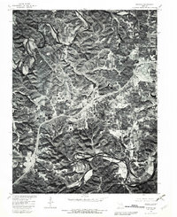
1980 Map of Stanton
USGS Topo · Published 1982About this map
The Meramec River and Bourbeuse River carve deep, winding channels through the Missouri landscape in this 1980 orthophotoquad. This specialized imagery, produced in cooperation with the Soil Conservation Service, offers a photographic look at the land use and vegetation surrounding the community of Stanton. To the east, the settlement of Anaconda sits near the crossing of major transit corridors, while the vicinity of Twin Springs highlights the transition between the agricultural bottomlands and the timbered hills. Unlike a standard topographic map, this survey uses rectified aerial photography taken in March 1980 to document the exact footprint of forest cover and road networks as they existed in the early 1980s.
Find a feature on this map
5 named features on this map. Tap any name to fly to it.
Don’t see what you’re looking for? This feature index may not catch every label — zoom into the map to look around manually.
Map Details
Editions of this 1980 Stanton Map
This is the sole edition of this map. No revisions or reprints were ever made.
Other maps of this area

1901 · De Soto
USGS Topo · 1:125,000

1903 · Sullivan
USGS Topo · 1:125,000

1934 · Meramec State Park
USGS Topo · 1:24,000

1937 · Meramec State Park
USGS Topo · 1:24,000

1946 · Richwoods
USGS Topo · 1:62,500

1946 · Union
USGS Topo · 1:62,500

1947 · Sullivan
USGS Topo · 1:62,500

1947 · St. Clair
USGS Topo · 1:62,500

1948 · Richwoods
USGS Topo · 1:62,500

1948 · Union
USGS Topo · 1:62,500