
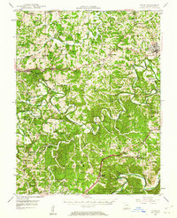
1946 Map of Union
USGS Topo · Published 1958About this map
The Bourbeuse River and Meramec River carve through this portion of Franklin County, defining a landscape of sharp ridges and deep creek valleys. In the mid-1940s, this area supported an extensive network of rural school districts, including the Old Beaufort Sch, Krakow Sch, and Spring Bluff Sch. The map reveals a transition from the county seat at Union toward more specialized rural sites like Benson Tourist City and the historic Moser Mill.
Find a feature on this map
96 named features on this map. Tap any name to fly to it.
Don’t see what you’re looking for? This feature index may not catch every label — zoom into the map to look around manually.
Map Details
Editions of this 1946 Union Map
2 editions found
Other maps of this area

1890 · Hermann
USGS Topo · 1:125,000

1901 · De Soto
USGS Topo · 1:125,000

1903 · O'Fallon
USGS Topo · 1:125,000

1903 · Sullivan
USGS Topo · 1:125,000

1934 · Meramec State Park
USGS Topo · 1:24,000

1935 · Gerald
USGS Topo · 1:48,000

1936 · Hermann
USGS Topo · 1:48,000

1937 · Meramec State Park
USGS Topo · 1:24,000

1941 · Gerald
USGS Topo · 1:62,500

1942 · Hermann
USGS Topo · 1:62,500