
Historical Maps of Missouri
What stories do these 4,846 old maps tell about Missouri's past? From 1884 to present day, these maps reveal the evolution of streets, neighborhoods, iconic landmarks, and natural features in stunning high-res detail. Whether you're a history enthusiast, genealogist, or professional in education, environmental work, or architecture, these maps are perfect for exploration, research, and discovery.
Discover Missouri's history through maps:
- Trace Missouri's growth: Explore earlier and latest maps and editions to uncover how the region changed over time.
- Examine technical details: Each map includes its creators, publishers, scale, dimensions, and full source information.
- Layer maps with modern tools & imagery: Compare historical maps to modern-day with high-resolution satellite imagery and detailed LiDAR layers.
- Sourced from trusted archives: Carefully preserved and digitized by institutions like the United Stated Geological Survey and the US Library of Congress.
- Access in any format: View and explore in high resolution, download for offline use, or order a museum-quality print for yourself or a loved one.
Begin your journey into Missouri's history with these remarkable must-see maps.
Missouri maps
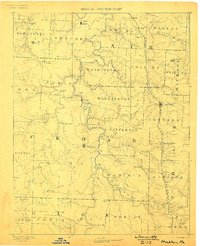
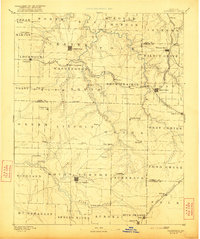
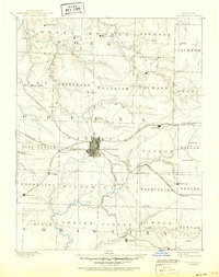
(4,846)- 1884 Map of Springfield
 1884 Springfield1884 Print · USGSCovers Missouri, including Springfield, Nixa, and other nearby areas
 - 1884 Map of Bolivar
 1884 Bolivar1884 Print · USGSCovers Missouri, including Bolivar, Buffalo, and other nearby areas
 - 1884 Map of Fort Scott, 1954 Print
 1884 Fort Scott1954 Print · USGSCovers Missouri, including Fort Scott, Girard, and other nearby areas
 - 1885 Map of Warrensburg, 1954 Print
 1885 Warrensburg1954 Print · USGSCovers Missouri, including Warrensburg, Odessa, and other nearby areas
 - 1885 Map of Atchison, 1954 Print
 1885 Atchison1954 Print · USGSCovers Missouri, including Atchison, Shannon, and other nearby areas
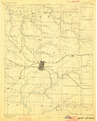
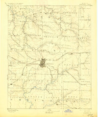
 - 1886 Map of Nevada
 1886 Nevada1886 Print · USGSCovers Missouri, including Nevada, Lamar, and other nearby areas
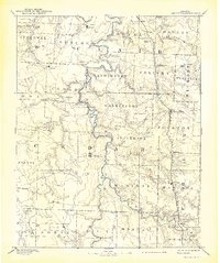
 - 1886 Map of Jefferson City
 1886 Jefferson City1886 Print · USGSCovers Missouri, including Columbia, Jefferson City, and other nearby areas
 - 1886 Map of Joplin
 1886 Joplin1886 Print · USGSCovers Missouri, including Joplin, Pittsburg, and other nearby areas
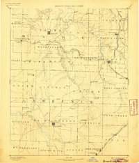
 - 1886 Map of Stockton
 1886 Stockton1886 Print · USGSCovers Missouri, including El Dorado Springs, Stockton, and other nearby areas
 - 1886 Map of Greenfield
 1886 Greenfield1886 Print · USGSCovers Missouri, including Republic, Mount Vernon, and other nearby areas
 - 1886 Map of Fort Scott
 1886 Fort Scott1886 Print · USGSCovers Missouri, including Fort Scott, Girard, and other nearby areas
 - 1886 Map of Carthage
 1886 Carthage1886 Print · USGSCovers Missouri, including Joplin, Carthage, and other nearby areas
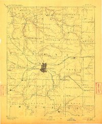
 - 1886 Map of Springfield, 1896 Print
 1886 Springfield1896 Print · USGSCovers Missouri, including Springfield, Nixa, and other nearby areas
 - 1886 Map of Stockton, 1898 Print
 1886 Stockton1898 Print · USGSCovers Missouri, including El Dorado Springs, Stockton, and other nearby areas
 - 1886 Map of Springfield, 1901 Print
 1886 Springfield1901 Print · USGSCovers Missouri, including Springfield, Nixa, and other nearby areas
 - 1886 Map of Greenfield, 1905 Print
 1886 Greenfield1905 Print · USGSCovers Missouri, including Republic, Mount Vernon, and other nearby areas
 - 1886 Map of Springfield, 1912 Print
 1886 Springfield1912 Print · USGSCovers Missouri, including Springfield, Nixa, and other nearby areas
 - 1886 Map of Greenfield, 1921 Print
 1886 Greenfield1921 Print · USGSCovers Missouri, including Republic, Mount Vernon, and other nearby areas
 - 1886 Map of Springfield, 1927 Print
 1886 Springfield1927 Print · USGSCovers Missouri, including Springfield, Nixa, and other nearby areas
 - 1886 Map of Stockton, 1939 Print
 1886 Stockton1939 Print · USGSCovers Missouri, including El Dorado Springs, Stockton, and other nearby areas
 - 1886 Map of Greenfield, 1950 Print
 1886 Greenfield1950 Print · USGSCovers Missouri, including Republic, Mount Vernon, and other nearby areas
 - 1886 Map of Springfield, 1950 Print
 1886 Springfield1950 Print · USGSCovers Missouri, including Springfield, Nixa, and other nearby areas
 - 1886 Map of Oskaloosa, 1954 Print
 1886 Oskaloosa1954 Print · USGSCovers Missouri, including Lawrence, Tonganoxie, and other nearby areas
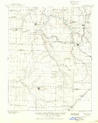
 - 1887 Map of Clinton
 1887 Clinton1887 Print · USGSCovers Missouri, including Clinton, Leesville, and other nearby areas
 - 1887 Map of Harrisonville
 1887 Harrisonville1887 Print · USGSCovers Missouri, including Kansas City, Lee's Summit, and other nearby areas
Showing maps 1-25 of 4,846
Top cities in Missouri
- Kansas City historical maps
- St. Louis historical maps
- Springfield historical maps
- Columbia historical maps
- Independence historical maps
- Lee's Summit historical maps
See more
Top counties in Missouri
- Saint Louis County historical maps
- Jackson County historical maps
- Saint Charles County historical maps
- St. Louis historical maps
- Greene County historical maps
- Clay County historical maps
See more
Frequently asked questions
- What are the different types of historical maps available for Missouri?
- What is the oldest map of Missouri?
- Where can I purchase historical maps of Missouri for my home or office?
- Where can I download high-res historical maps of Missouri?
- Are there historical topographic maps available for Missouri?
- Is there historical aerial imagery available for Missouri?
- Where are historical maps of Missouri sourced from?