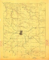
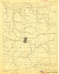
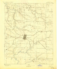
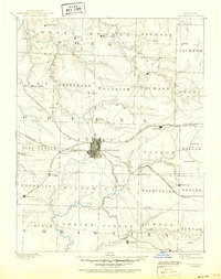
1886 Map of Springfield
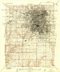
USGS Topo · Published 1912About this map
Springfield stands at the center of a bustling rail hub in the mid-1880s, where the St Louis and San Francisco Railroad intersects with the Kansas City and Scott and Memphis Railroad. This late 19th-century landscape is defined by its transition from prairie to river breaks, with the city plat clearly delineated at the heart of Campbell township. The map illustrates a dense network of satellite communities and stops that supported the regional economy, including Republic, Willard, and Stafford.
Find a feature on this map
67 named features on this map. Tap any name to fly to it.
Don’t see what you’re looking for? This feature index may not catch every label — zoom into the map to look around manually.
Map Details
Editions of this 1886 Springfield Map
5 editions found
Other maps of this area

1884 · Springfield
USGS Topo · 1:125,000

1884 · Bolivar
USGS Topo · 1:125,000

1886 · Stockton
USGS Topo · 1:125,000

1886 · Greenfield
USGS Topo · 1:125,000

1886 · Springfield
USGS Topo · 1:125,000

1888 · Greenfield
USGS Topo · 1:125,000

1892 · Bolivar
USGS Topo · 1:125,000

1907 · Forsyth
USGS Topo · 1:125,000

1919 · Halltown
USGS Topo · 1:62,500
1935 · Springfield
USGS Topo · 1:24,000