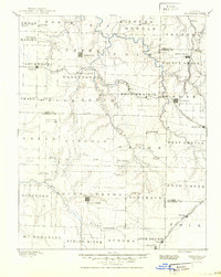
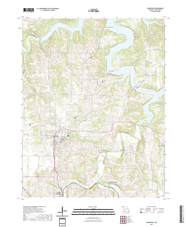
1888 Map of Greenfield
USGS Topo · Published 1898About this map
Greenfield and Mount Vernon serve as the primary hubs for this late nineteenth-century portrait of Southwest Missouri. The landscape is defined by the headwaters of the Spring River and a dense network of tributaries including Turnback Creek and Limestone Creek. This era captures the region's transition into a vital rail corridor, with the Kansas City Ft. Scott and Gulf Railroad and the Kansas City Clinton and Springfield Railroad cutting through the prairie to connect remote settlements. Small post offices and community centers like Paris Springs, Chesapeake, and Halltown dot the landscape, illustrating the proximity of rural life to the emerging rail stops at Everton and Ash Grove. In the northern sections, family-named landmarks like Sim's Point and Gray's Valley suggest the early local topography known to the area's first established families.
Find a feature on this map
73 named features on this map. Tap any name to fly to it.
Don’t see what you’re looking for? This feature index may not catch every label — zoom into the map to look around manually.
Map Details
Editions of this 1888 Greenfield Map
This is the sole edition of this map. No revisions or reprints were ever made.
Historical Maps of Republic Through Time
7 maps found