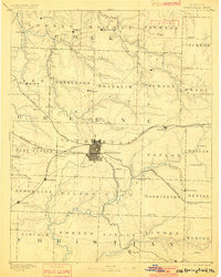
1886 Map of Springfield
USGS Topo · Published 1901About this map
Springfield serves as the central hub of this 1880s survey, showing a detailed street grid where three major rail lines converge. The St. Louis and San Francisco Railroad and the Kansas City and Scott Railroad anchor the regional economy, connecting the city to outlying towns like Republic and Stafford. The landscape is defined by the Ozark Plateau drainage, where the Sac River and Little Pomme de Terre River flow through a patchwork of rural townships.
Find a feature on this map
71 named features on this map. Tap any name to fly to it.
Don’t see what you’re looking for? This feature index may not catch every label — zoom into the map to look around manually.
Map Details
Editions of this 1886 Springfield Map
5 editions found
Other maps of this area

1884 · Springfield
USGS Topo · 1:125,000

1884 · Bolivar
USGS Topo · 1:125,000

1886 · Stockton
USGS Topo · 1:125,000

1886 · Greenfield
USGS Topo · 1:125,000

1886 · Springfield
USGS Topo · 1:125,000

1888 · Greenfield
USGS Topo · 1:125,000

1892 · Bolivar
USGS Topo · 1:125,000

1907 · Forsyth
USGS Topo · 1:125,000

1919 · Halltown
USGS Topo · 1:62,500

1935 · Springfield
USGS Topo · 1:24,000