Old Maps of Cape Girardeau County, Missouri
Explore 133 old maps of Cape Girardeau County, spanning from 1918 to today. These high-resolution historic maps reveal how streets, neighborhoods, landmarks, and natural features evolved over time — perfect for genealogy, metal detecting, research, and local history exploration.
What you can do with these maps:
- See how Cape Girardeau County changed over time: Compare historical maps to modern-day views to trace roads, homesites, rail lines & more.
- View detailed metadata: Each map includes creators, publishers, year, scale, and archive source.
- Overlay maps with satellite & LiDAR: Visualize the past alongside modern tools to explore terrain & human change.
- Trusted historical sources: Maps sourced from the USGS, Library of Congress, and other archives.
- Access maps your way: View online, download high-res files, or order prints for personal or research use.
Start exploring old maps of Cape Girardeau County to uncover forgotten places, hidden landmarks, and the deep history beneath your feet.
Cape Girardeau County, MO maps
(133)- 1918 Map of Altenburg
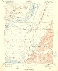
 1918 Altenburg1918 Print · USGSThe riverfronts of Perry and Jackson counties were still shaped by steam and rail when this survey was completed during the First World War. Local historians can trace family ties to small communities like Neunert and Jacob or locate old schoolhouse sites such as Hanlein School.
 - 1920 Map of Jonesboro
 1920 Jonesboro1920 Print · USGSSouthern Illinois during the late post-war era reveals a complex landscape of Mississippi riverfront bottoms and high ridges. Genealogists can trace family roots through numerous local landmarks, from the Casper Church to rural schools like Big Barn School and McClure School.
 - 1922 Map of Cape Girardeau, 1954 Print
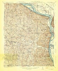
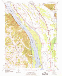
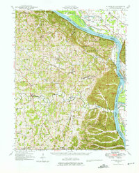
 1922 Cape Girardeau1954 Print · USGSThe Missouri-Illinois riverfront was a bustling corridor of rail and river commerce in the early 1920s. Genealogists can trace family names through dozens of rural landmarks like Rock Hill Church, Needmore School, and the river landing at Neelys Landing.3 unique versions available
 - 1923 Map of Jonesboro
 1923 Jonesboro1923 Print · USGSThe Mississippi River bottoms and Shawnee hills meet in the early 1920s, showing a landscape of rail-dependent towns and rural schools. Trace family roots at Casper Church, follow the Mobile and Ohio Railroad, or locate Moccasin Springs.2 unique versions available
 - 1923 Map of Perryville, 1960 Print
 1923 Perryville1960 Print · USGSSoutheast Missouri's rural townships are documented here during the early twenties, showing a landscape of small mill sites and dozens of neighborhood schools. Researchers can trace family origins through locations like St Marys Seminary, Bollingers Mill, and Schumer Springs.2 unique versions available
 - 1924 Map of Cape Girardeau
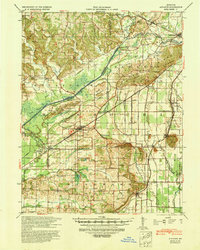
 1924 Cape Girardeau1924 Print · USGSCape Girardeau County in the early twenties shows a bustling riverfront and a landscape dotted with over twenty rural schoolhouses. Genealogists can trace family roots near Needmore School, Pocahontas Sta, and the historic Pleasant Hill Church.2 unique versions available
 - 1924 Map of Perryville
 1924 Perryville1924 Print · USGSSoutheast Missouri in the early 1920s was a landscape of small river towns and family-named landmarks at the intersection of three counties. Genealogists can trace family roots through numerous country schools like Sim Layton School and local mills such as Bollingers Mill.2 unique versions available
 - 1924 Map of Alto Pass
 1924 Alto Pass1924 Print · USGSSouthern Illinois at the peak of the rail era shows a landscape of river ferries and ridge-top settlements. Genealogists can trace family footprints across dozens of local landmarks like Rattlesnake Ferry, Goodbread Church, and Worthen School.2 unique versions available
 - 1925 Map of Altenburg
 1925 Altenburg1925 Print · USGSEastern Perry County and the Mississippi riverfront are documented here during the mid-twenties, showcasing a landscape of Saxon Lutheran heritage and river commerce. Genealogists can locate family landmarks like New Bethel Church, Hager School, and the vanished river site of Wittenberg.3 unique versions available
 - 1933 Map of Marble Hill, 1964 Print
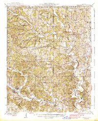
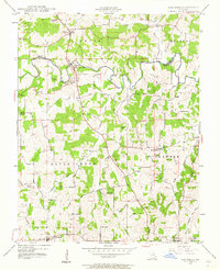
 1933 Marble Hill1964 Print · USGSBollinger and Cape Girardeau counties in the early 1930s reveal a landscape of rural schoolhouses and family-named landmarks. Trace the Missouri Pacific rail line through Lutesville or find local community sites like Whiskey Sch and Gravel Hill Ch.3 unique versions available
 - 1934 Map of Thebes
 1934 Thebes1934 Print · USGSThe Mississippi River corridor south of Thebes shows a landscape of rail junctions and bottomland farming in the 1930s. Genealogists can locate family landmarks like Pollard Cemetery, Mt Zion Ch, and schools such as Ownsby Sch or Lemon Sch.4 unique versions available
 - 1934 Map of Morley
 1934 Morley1934 Print · USGSSoutheastern Missouri during the 1930s reveals a landscape being reshaped by massive drainage projects. Genealogists can trace family roots at Hunter Sch or locate ancestors in settlements like Morley, Benton, and the rail junction at Brooks Junction.3 unique versions available
 - 1934 Map of Advance
 1934 Advance1934 Print · USGSSoutheast Missouri in the 1930s is mapped here during a period of major hydrological change and railroad activity. You can trace the Diversion Channel across the landscape or find rural schools and family burial sites like Toga No 2 Sch and St Joseph Cem.3 unique versions available
 - 1937 Map of Marble Hill
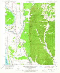
 1937 Marble Hill1937 Print · USGSSoutheast Missouri in the mid-thirties remains a landscape of small crossroads and one-room schools like Hamestring Sch. You can trace the Missouri Pacific rail line through Lutesville or locate family sites at Pulliam Cem and Barks Chapel.2 unique versions available
 - 1939 Map of Morley, 1942 Print
 1939 Morley1942 Print · USGSSoutheast Missouri was undergoing a massive hydrological transformation in the late 1930s as engineers redirected the Whitewater River. Genealogists and historians can trace rail-depot towns like Chaffee and Morley alongside vanished rural landmarks like Bryan Sch and Brooks Junction.2 unique versions available
 - 1939 Map of Advance, 1942 Print
 1939 Advance1942 Print · USGSSoutheast Missouri in the late thirties is defined here by its massive drainage projects and thriving rail towns. Researchers can trace the heritage of rural communities through dozens of local landmarks like Cruse Cem, Dongola Sch, and Union Grove Ch.
 - 1939 Map of Thebes, 1946 Print
 1939 Thebes1946 Print · USGSSouthern Illinois and the Mississippi River bottomlands are captured here just before the 1940s, showing a landscape defined by rail junctions and river islands. Genealogists can locate family landmarks like Pollard Cemetery, Unity Ch, and several rural schoolhouses including Powers Island Sch.
 - 1947 Map of Jonesboro, 1954 Print
 1947 Jonesboro1954 Print · USGSSouthern Illinois in the late 1940s reveals a landscape defined by the Mississippi riverfront and the deep woods of the Shawnee National Forest. Researchers can trace early rural infrastructure through numerous sites like Egypt Mills, Dutch Mills, and the historic Kornthal Church.3 unique versions available
 - 1947 Map of Alto Pass, 1954 Print
 1947 Alto Pass1954 Print · USGSSouthern Illinois in the late 1940s is defined by the high ridges of the Shawnee Hills and the sweeping Mississippi floodplains. Researchers can trace rural life through sites like Dutch Ridge Church, the Macedonia School, and the river crossing at Rattlesnake Ferry.2 unique versions available
 - 1947 Map of Mc Clure, 1954 Print
 1947 Mc Clure1954 Print · USGSThe Illinois-Missouri borderlands along the Mississippi River come to life in the late 1940s, showing a landscape defined by flood control and rail transport. Trace local history through the Illinois Central Railroad and landmarks like McClure or Hobbs Chapel.3 unique versions available
 - 1947 Map of Oak Ridge, 1964 Print
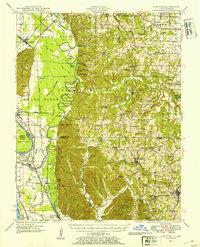
 1947 Oak Ridge1964 Print · USGSPerry and Cape Girardeau counties are captured here in the late 1940s, a period when rural school districts and small post offices still anchored Missouri life. Researchers can trace family roots through numerous sites like Old Appleton (PO), Zion Ch, and Liberty Sch No 1.2 unique versions available
 - 1947 Map of Wolf Lake, 1966 Print
 1947 Wolf Lake1966 Print · USGSThe Mississippi River bottoms and Shawnee National Forest hills meet in the late 1940s, showing a landscape shaped by rail and river. Genealogists can trace local landmarks like Galilee Ch and rural schoolhouses such as Cauble Sch and McCann Sch.3 unique versions available
 - 1947 Map of Ware, 1969 Print
 1947 Ware1969 Print · USGSThe Mississippi River border near Ware and Egypt Mills is captured here in the late 1940s, showing a landscape of fertile floodplains and wooded bluffs. Researchers can trace historic river access points like Neelys Landing and several rural schoolhouses, including Big Barn Sch and Iona Sch.3 unique versions available
 - 1947 Map of Altenburg, 1976 Print
 1947 Altenburg1976 Print · USGSSoutheastern Missouri's river bluffs and Lutheran heritage are documented here in the mid-forties, showing the close-knit network of river landings and small-town commerce. Genealogists can trace family footprints across Altenburg, Frohna, and dozens of rural schools like Fiehler Sch or Buckeye Sch.
 - 1948 Map of Ware
 1948 Ware1948 Print · USGSThe Mississippi River corridor bustles with river and rail activity just after the war, connecting small Illinois landings with the Missouri hills. Genealogists can trace family roots through several rural schoolhouses like Miller Pond Sch and Iona Sch, or locate the Rallp Cem near the Shawnee National Forest.2 unique versions available
Showing maps 1-25 of 133
Top cities of Cape Girardeau County
- Cape Girardeau historical maps
- Jackson historical maps
- Delta historical maps
- Gordonville historical maps
- Oak Ridge historical maps
- Pocahontas historical maps
See more
Frequently asked questions
- What are the different types of historical maps available for Cape Girardeau County?
- What is the oldest map of Cape Girardeau County?
- Where can I purchase historical maps of Cape Girardeau County for my home or office?
- Where can I download high-res historical maps of Cape Girardeau County?
- Are there historical topographic maps available for Cape Girardeau County?
- Is there historical aerial imagery available for Cape Girardeau County?
- Where are historical maps of Cape Girardeau County sourced from?