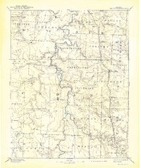
1886 Map of Stockton
USGS Topo · Published 1939About this map
Stockton serves as the central hub of this Missouri landscape, surveyed in the mid-1880s when the region was defined by small agricultural settlements and a burgeoning rail network. The Kansas City Clinton and Springfield R. R. cuts through the eastern portion of the map, connecting towns like Humansville and Fair Play. The topography is intricately carved by a dense network of waterways including Turkey Creek, Silver Creek, and Weaubleau Creek, which dictated the placement of early infrastructure. Local industry and social centers are represented by Johnson's Mill and various crossroads communities such as Jerico Springs and Sacville. This survey by R. U. Goode provides a detailed look at the township divisions across Cedar, St. Clair, and Dade counties, capturing the era of post-Civil War settlement before modern highways altered the rural landscape.
Find a feature on this map
60 named features on this map. Tap any name to fly to it.
Don’t see what you’re looking for? This feature index may not catch every label — zoom into the map to look around manually.
Map Details
Editions of this 1886 Stockton Map
3 editions found
Other maps of this area

1884 · Springfield
USGS Topo · 1:125,000

1884 · Bolivar
USGS Topo · 1:125,000

1886 · Nevada
USGS Topo · 1:125,000

1886 · Stockton
USGS Topo · 1:125,000

1886 · Greenfield
USGS Topo · 1:125,000

1886 · Carthage
USGS Topo · 1:125,000

1886 · Springfield
USGS Topo · 1:125,000

1887 · Clinton
USGS Topo · 1:125,000

1887 · Warsaw
USGS Topo · 1:125,000

1887 · Butler
USGS Topo · 1:125,000