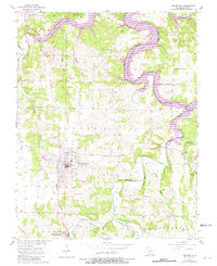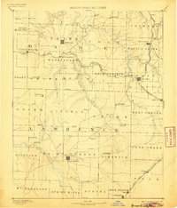
1886 Map of Greenfield
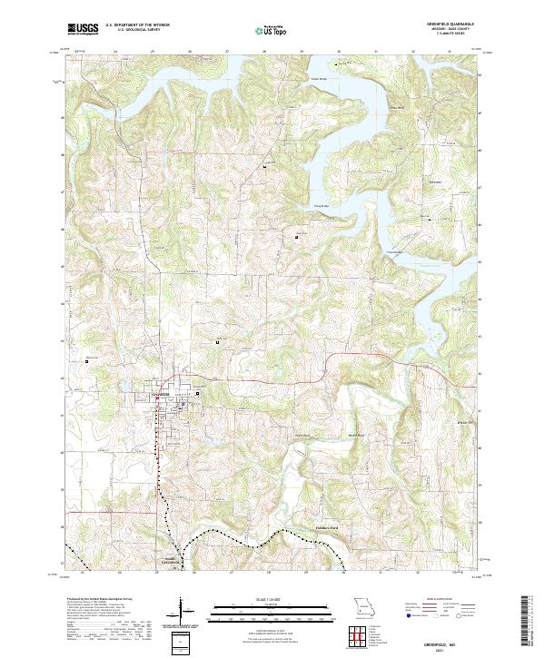
USGS Topo · Published 1905About this map
Mount Vernon and Greenfield anchor this Southwest Missouri landscape during a period of rapid railroad expansion and agricultural settlement. The map reveals the intricate network of late 19th-century transit, defined by the Kansas City Ft. Scott and Gulf Railroad and the Kansas City Clinton and Springfield Railroad as they cut through the prairies. Small communities such as Paris Springs, Lawrenceburg, and Lockwood are shown at their early heights, often situated near water sources like Turnback Creek or Sinking Creek. The drainage of the Spring River and its various tributaries like Stahl Creek and Honey Creek shaped the placement of farmsteads and rural townships. Researchers will find a wealth of early place names including Sim's Point, Gray's Valley, and Forest Home, many of which were central to local commerce before the turn of the century.
Find a feature on this map
73 named features on this map. Tap any name to fly to it.
Don’t see what you’re looking for? This feature index may not catch every label — zoom into the map to look around manually.
Map Details
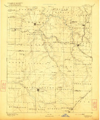
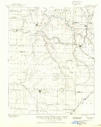
Editions of this 1886 Greenfield Map
4 editions found

Historical Maps of Republic Through Time
7 maps found