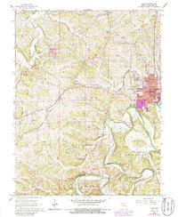
1966 Map of Union
USGS Topo · Published 1986About this map
The town of Union serves as a focal point in this survey of central Franklin County, characterized by the convergence of the Chicago and Rock Island Pacific railroad and the winding Bourbeuse River. In the mid-1960s, the landscape was primarily rural, dotted with small communities like Jeffriesburg, Krakow, and Neier. The map reveals a high density of local history markers, particularly family and church cemeteries such as Meyer Cem, Peters Cem, and St Johns Ch (Cem). Notable landmarks include the Courthouse in the county seat and the Radio Tower (KLPW) north of town. The terrain is deeply dissected by numerous creeks, including St Johns Creek, Flat Creek, and Buescher Creek, reflecting a land shaped by its drainage into the Bourbeuse. Revisions from 1978 and 1980, shown in purple, document the expanding residential footprint of Union toward the river and along major transit corridors.
Find a feature on this map
43 named features on this map. Tap any name to fly to it.
Don’t see what you’re looking for? This feature index may not catch every label — zoom into the map to look around manually.
Map Details
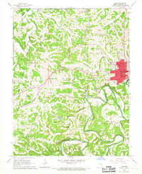
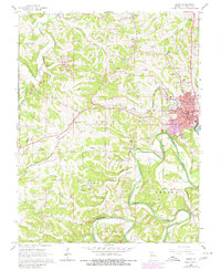
Editions of this 1966 Union Map
3 editions found
Other maps of this area

1890 · Hermann
USGS Topo · 1:125,000

1901 · De Soto
USGS Topo · 1:125,000

1903 · O'Fallon
USGS Topo · 1:125,000

1903 · Sullivan
USGS Topo · 1:125,000

1946 · Union
USGS Topo · 1:62,500

1947 · St. Clair
USGS Topo · 1:62,500

1948 · Union
USGS Topo · 1:62,500

1948 · Washington
USGS Topo · 1:62,500

1948 · Augusta
USGS Topo · 1:62,500

1949 · Saint Louis
USGS Topo · 1:250,000