2022 Map of Greeley
USGS Topo · Published 2022About this map
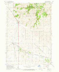
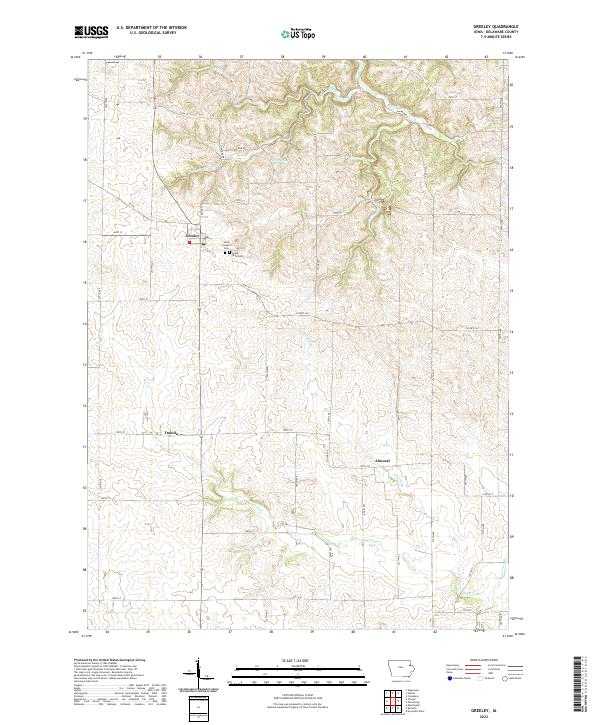
Greeley anchors the landscape of northern Delaware County, situated at the intersection of local routes that connect this agricultural hub to the surrounding countryside. The terrain is defined by a dense network of waterways, including Plum Creek and Fountain Springs Creek, which carve through the Iowa plains. Small communities like Oneida and Almoral highlight the rural settlement pattern that has persisted for generations. Local history and genealogy are well-represented by landmarks such as Saint Joseph's Cemetery and Grant View Cemetery, both located near the center of the township. A notable geographic feature, Fountain Mill Spring, suggests the historical importance of natural water sources to early industry and agriculture in the region. The map captures the enduring structure of the Iowa section-line road system, with thoroughfares like County Highway C64 and County Highway D13 facilitating movement between family farms and regional centers.
Find a feature on this map
38 named features on this map. Tap any name to fly to it.
Don’t see what you’re looking for? This feature index may not catch every label — zoom into the map to look around manually.
Map Details
Editions of this 2022 Greeley Map
This is the sole edition of this map. No revisions or reprints were ever made.