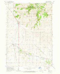
1965 Map of Greeley
USGS Topo · Published 1967About this map
Greeley and the surrounding townships of Elk and Oneida define this mid-1960s portrait of northern Delaware County. The landscape is characterized by the convergence of major rail lines, including the Chicago Milwaukee St Paul and Pacific and the Chicago Great Western, which shaped the development of local hubs like Oneida and Almoral. These railroads were essential to the agricultural and industrial output of the region, connecting local resources to larger markets.
Find a feature on this map
25 named features on this map. Tap any name to fly to it.
Don’t see what you’re looking for? This feature index may not catch every label — zoom into the map to look around manually.
Map Details
Editions of this 1965 Greeley Map
This is the sole edition of this map. No revisions or reprints were ever made.
Other maps of this area

1900 · Anamosa
USGS Topo · 1:125,000

1902 · Elkader
USGS Topo · 1:125,000

1957 · Colesburg
USGS Topo · 1:24,000

1959 · Dubuque
USGS Topo · 1:250,000

1961 · Dubuque
USGS Topo · 1:250,000

1962 · Dubuque
USGS Topo · 1:250,000

1962 · Petersburg
USGS Topo · 1:24,000

1964 · Edgewood
USGS Topo · 1:24,000

1964 · Garber
USGS Topo · 1:24,000

1965 · Thorpe
USGS Topo · 1:24,000