
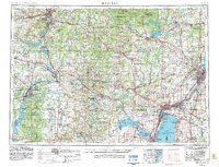
1955 Map of Green Bay
USGS Topo · Published 1968About this map
Lake Winnebago and the industrial corridors of the Fox River dominate this mid-century landscape, capturing Central and Northeast Wisconsin during a period of significant post-war infrastructure. The map details the urbanization of the Fox Valley from Appleton and Oshkosh to Green Bay, while the Wisconsin River serves as the spine for heavy industry and power generation at Wisconsin Rapids, Stevens Point, and Wausau. High-elevation landmarks like Rib Mountain overlook the Big Eau Pleine Reservoir, contrasting with the complex hydrology of the western lake system including Lake Poygan and Lake Winneconne. Extensive rail networks such as the Soo Line and Chicago and North Western connect these mill towns and agricultural centers, while the Oneida Indian Reservation and the Stockbridge Indian Reservation define large tracts of protected land in the north and east.
Find a feature on this map
71 named features on this map. Tap any name to fly to it.
Don’t see what you’re looking for? This feature index may not catch every label — zoom into the map to look around manually.
Map Details
Editions of this 1955 Green Bay Map
2 editions found
Other maps of this area

1899 · Wausau
USGS Topo · 1:125,000

1902 · Wausau
USGS Topo · 1:125,000

1902 · Marathon
USGS Topo · 1:125,000

1910 · Fond du Lac
USGS Topo · 1:62,500

1911 · Neenah
USGS Topo · 1:62,500

1915 · Neshkoro
USGS Topo · 1:48,000

1916 · Ripon
USGS Topo · 1:48,000

1918 · Neshkoro
USGS Topo · 1:62,500

1918 · Ripon
USGS Topo · 1:62,500

1921 · Mauston
USGS Topo · 1:62,500