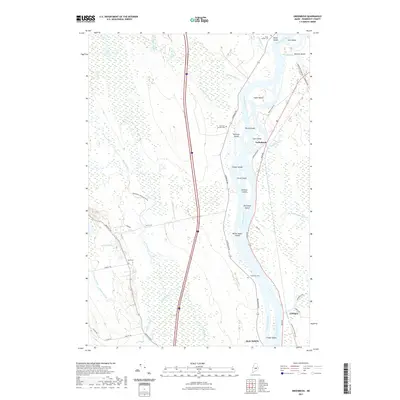
2021 Map of Greenbush
USGS Topo · Published 2021About this map
The Penobscot River serves as the dominant geographical feature in this survey, carving a complex path through Penobscot County that includes numerous named islands like Sugar Island, White Squaw Island, and Thorofare Island. The settlement patterns of Greenbush and Costigan follow the river's eastern bank along Main Rd, showing a reliance on the waterway and the north-south transport corridor. West of the river, the landscape transitions into the expansive Alton Bog, where drainage is defined by Birch Stream and Hemlock Stream. Local heritage is anchored by several small burial grounds, including Cedarvale Cem and Hemlock Stream Cem, which sit near the river's edge. The network of secondary roads like Argyle Rd and Southgate Rd suggests a community shaped by its proximity to both the river and the marshy interior lowlands.
Find a feature on this map
52 named features on this map. Tap any name to fly to it.
Don’t see what you’re looking for? This feature index may not catch every label — zoom into the map to look around manually.
Map Details
Editions of this 2021 Greenbush Map
This is the sole edition of this map. No revisions or reprints were ever made.
Other maps of this area

1902 · Orono
USGS Topo · 1:62,500

1902 · Bangor
USGS Topo · 1:62,500

1917 · Passadumkeag
USGS Topo · 1:62,500

1933 · Boyd Lake
USGS Topo · 1:62,500

1942 · Bangor
USGS Topo · 1:62,500

1944 · Orono
USGS Topo · 1:62,500

1946 · Bangor
USGS Topo · 1:62,500

1946 · Orono
USGS Topo · 1:62,500

1948 · Bangor
USGS Topo · 1:250,000

1951 · Boyd Lake
USGS Topo · 1:50,000