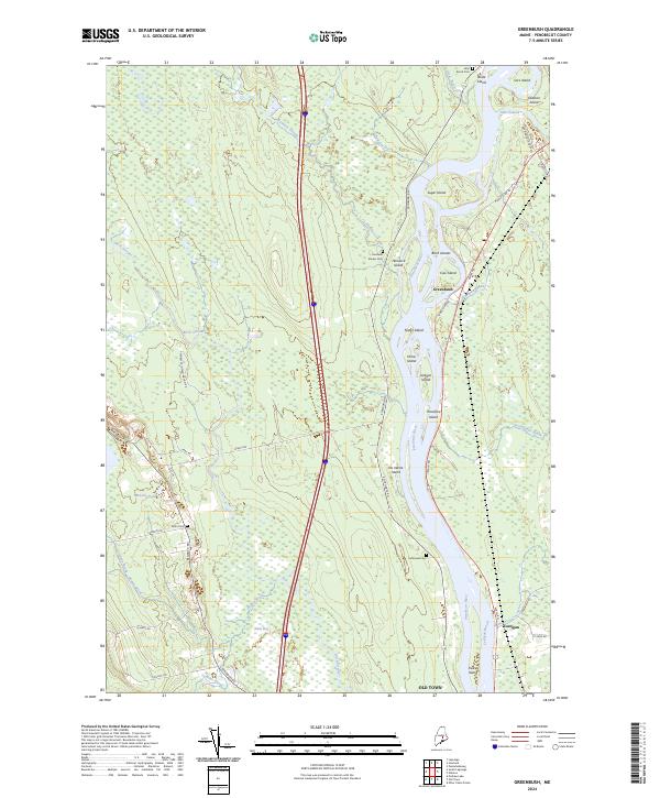
2024 Map of Greenbush
USGS Topo · Published 2024About this map
The Penobscot River serves as the dominant geographical feature here, carving a complex channel through northern Maine that creates a long chain of islands including Sugar Island, Thorofare Island, and Olamon Island. This river-centric landscape is shaped by the interplay of these waterways and the sprawling wetlands of Alton Bog. Settlement patterns follow the river's edge and the rural corridors of Main Rd and Bennoch Rd, where local history is anchored by the Alton Cem and Cedarvale Cem. The map also illustrates contemporary land use through the presence of the Penobscot Indian Nation Rd and the central transit corridor of the Interstate highway. To the west, the terrain transitions into dense forest and swampy lowlands drained by Hemlock Stream and Birch Stream, offering a detailed view of the region's hydrography and rural infrastructure.
Find a feature on this map
48 named features on this map. Tap any name to fly to it.
Don’t see what you’re looking for? This feature index may not catch every label — zoom into the map to look around manually.
Map Details
Editions of this 2024 Greenbush Map
This is the sole edition of this map. No revisions or reprints were ever made.
Other maps of this area

1902 · Orono
USGS Topo · 1:62,500

1902 · Bangor
USGS Topo · 1:62,500

1917 · Passadumkeag
USGS Topo · 1:62,500

1933 · Boyd Lake
USGS Topo · 1:62,500

1942 · Bangor
USGS Topo · 1:62,500

1944 · Orono
USGS Topo · 1:62,500

1946 · Bangor
USGS Topo · 1:62,500

1946 · Orono
USGS Topo · 1:62,500

1948 · Bangor
USGS Topo · 1:250,000

1951 · Boyd Lake
USGS Topo · 1:50,000