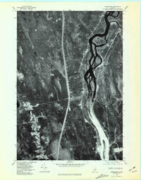
1975 Map of Greenbush
USGS Topo · Published 1981About this map
The Penobscot River dominates this 1975 orthophotograph, winding through the heavily wooded terrain of central Maine. This aerial perspective, captured in the mid-1970s, reveals the intricate braided channels and islands of the river as it flows past the small settlements of Greenbush and Costigan. The map provides a unique visual record of the land use patterns of the era, where cleared agricultural plots and small homesteads contrast sharply against the dark canopy of the surrounding forests. Two primary waterways, Hemlock Stream and Birch Stream, drain into the river system, carving narrow paths through the landscape. The layout of roads and structures along the river corridor illustrates the historical reliance on this major waterway for transportation and settlement in Penobscot County.
Find a feature on this map
5 named features on this map. Tap any name to fly to it.
Don’t see what you’re looking for? This feature index may not catch every label — zoom into the map to look around manually.
Map Details
Editions of this 1975 Greenbush Map
This is the sole edition of this map. No revisions or reprints were ever made.
Other maps of this area

1902 · Orono
USGS Topo · 1:62,500

1902 · Bangor
USGS Topo · 1:62,500

1917 · Passadumkeag
USGS Topo · 1:62,500

1933 · Boyd Lake
USGS Topo · 1:62,500

1942 · Bangor
USGS Topo · 1:62,500

1944 · Orono
USGS Topo · 1:62,500

1946 · Bangor
USGS Topo · 1:62,500

1946 · Orono
USGS Topo · 1:62,500

1948 · Bangor
USGS Topo · 1:250,000

1951 · Boyd Lake
USGS Topo · 1:50,000