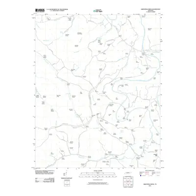
2010 Map of Greenfield Bend
USGS Topo · Published 2010About this map
The Duck River meanders through the heart of this landscape, creating dramatic bends such as Greenfield Bend and Shelby Bend. This Tennessee terrain is deeply dissected by numerous hollows and ridges, from the high Saunders Ridge to the narrow Buzzard Roost Hollow. The mapping reveals a dense network of family and local cemeteries that reflect generations of settlement along the waterways, including Sheboss Cemetery and Old Cathey Cemetery. Transport history is visible in the route of the Natchez Trace Pkwy, which traverses the hills near landmarks like Jackson Falls. The presence of the Weatherly Lookout Tower atop the ridge and the small community of Chapel Hill indicate the area's rural character. A complex drainage system including Blue Buck Creek, Catheys Creek, and Ugly Creek defines the local topography, shaping the agricultural and residential patterns of this Maury County region.
Find a feature on this map
152 named features on this map. Tap any name to fly to it.
Don’t see what you’re looking for? This feature index may not catch every label — zoom into the map to look around manually.
Map Details
Editions of this 2010 Greenfield Bend Map
This is the sole edition of this map. No revisions or reprints were ever made.
Other maps of this area

1901 · Colombia
USGS Topo · 1:125,000

1936 · Williamsport
USGS Topo · 1:24,000

1936 · Primm
USGS Topo · 1:24,000

1936 · Mt Joy
USGS Topo · 1:24,000

1936 · Nunnelly
USGS Topo · 1:24,000

1936 · Sunrise
USGS Topo · 1:24,000

1936 · Littlelot
USGS Topo · 1:24,000

1936 · Greenfield Bend
USGS Topo · 1:24,000

1936 · Mount Pleasant
USGS Topo · 1:24,000

1936 · Gordonsburg
USGS Topo · 1:24,000