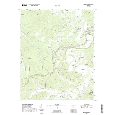
2019 Map of Greenfield Bend
USGS Topo · Published 2019About this map
Duck River meanders through the heart of this landscape, carving deep bends and hollows along the borders of Maury, Hickman, and Lewis counties. The Natchez Trace Parkway serves as a modern corridor through this historic region, tracing the path of the old frontier road. Notable river crossings like the Gordon Ferry Bridge near Shady Grove highlight the area's historical reliance on ferry points and river-based transport.
Find a feature on this map
186 named features on this map. Tap any name to fly to it.
Don’t see what you’re looking for? This feature index may not catch every label — zoom into the map to look around manually.
Map Details
Editions of this 2019 Greenfield Bend Map
This is the sole edition of this map. No revisions or reprints were ever made.
Other maps of this area

1901 · Colombia
USGS Topo · 1:125,000

1936 · Williamsport
USGS Topo · 1:24,000

1936 · Primm
USGS Topo · 1:24,000

1936 · Mt Joy
USGS Topo · 1:24,000

1936 · Nunnelly
USGS Topo · 1:24,000

1936 · Sunrise
USGS Topo · 1:24,000

1936 · Littlelot
USGS Topo · 1:24,000

1936 · Greenfield Bend
USGS Topo · 1:24,000

1936 · Mount Pleasant
USGS Topo · 1:24,000

1936 · Gordonsburg
USGS Topo · 1:24,000