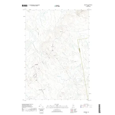
2018 Map of Greenfield
USGS Topo · Published 2018About this map
Greenfield and the nearby junction at Crocker Turn anchor this landscape of the Maine woods, where the terrain is defined by low rises like Cemetery Hill and Summit Mtn. The area is densely threaded with water, featuring the winding course of Olamon Stream and its tributaries, including N Br Olamon Stream and Avery Brook. These waterways and associated wetlands, such as those around Olamon Pond, have historically shaped the local timber and hunting grounds in Penobscot County. For genealogists and local historians, the presence of numbered burial sites like Number One Cem and Number Two Cem provides specific points for tracing early families in this township. The road network, including the eponymous Greenfield Rd and timber-hauling routes like Tannery Rd, reflects a history of small-scale settlement and forest-based industry along the border with Hancock County.
Find a feature on this map
36 named features on this map. Tap any name to fly to it.
Don’t see what you’re looking for? This feature index may not catch every label — zoom into the map to look around manually.
Map Details
Editions of this 2018 Greenfield Map
This is the sole edition of this map. No revisions or reprints were ever made.
Other maps of this area

1902 · Orono
USGS Topo · 1:62,500

1917 · Passadumkeag
USGS Topo · 1:62,500

1929 · Great Pond
USGS Topo · 1:48,000

1931 · Saponac
USGS Topo · 1:48,000

1932 · Great Pond
USGS Topo · 1:62,500

1934 · Saponac
USGS Topo · 1:62,500

1944 · Orono
USGS Topo · 1:62,500

1946 · Orono
USGS Topo · 1:62,500

1948 · Bangor
USGS Topo · 1:250,000

1954 · Millinocket
USGS Topo · 1:250,000
Featured Places
- Greenfield Township, ME
- Grand Falls Township, ME
- Summit Township, ME
- T39 MD BPP, ME
- Crocker Turn, Greenfield Township