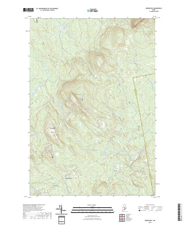
2024 Map of Greenfield
USGS Topo · Published 2024About this map
Greenfield sits within a landscape defined by significant timberlands and the complex water systems of the Olamon Stream and Sunkhaze Stream. This interior section of Maine is characterized by high ridges and distinct elevations such as Passadumkeag Mtn and Summit Mtn, which overlook a network of logging roads and local ways including Will White Rd and Greenfield Rd. For those researching local lineages, the map identifies two primary burial sites: Number One Cem situated near Cemetery Hill and Number Two Cem further south. The drainage patterns are intricate, with Avery Brook and Ledge Brook feeding into larger basins, while Olamon Pond serves as a prominent water feature near the eastern border where the line between Hancock and Penobscot Counties is marked. The settlement of Crocker Turn anchors the southern portion of the quadrangle, illustrating the dispersed nature of habitation in this forested region.
Find a feature on this map
35 named features on this map. Tap any name to fly to it.
Don’t see what you’re looking for? This feature index may not catch every label — zoom into the map to look around manually.
Map Details
Editions of this 2024 Greenfield Map
This is the sole edition of this map. No revisions or reprints were ever made.
Other maps of this area

1902 · Orono
USGS Topo · 1:62,500

1917 · Passadumkeag
USGS Topo · 1:62,500

1929 · Great Pond
USGS Topo · 1:48,000

1931 · Saponac
USGS Topo · 1:48,000

1932 · Great Pond
USGS Topo · 1:62,500

1934 · Saponac
USGS Topo · 1:62,500

1944 · Orono
USGS Topo · 1:62,500

1946 · Orono
USGS Topo · 1:62,500

1948 · Bangor
USGS Topo · 1:250,000

1954 · Millinocket
USGS Topo · 1:250,000
Featured Places
- Greenfield Township, ME
- Summit Township, ME
- T39 MD BPP, ME
- Crocker Turn, Greenfield Township
- Grand Falls Township, ME