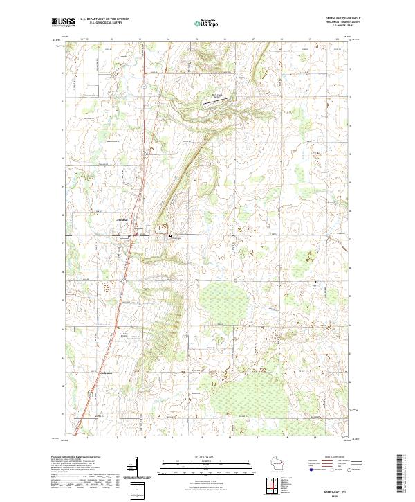
2022 Map of Greenleaf
USGS Topo · Published 2022About this map
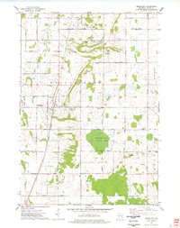
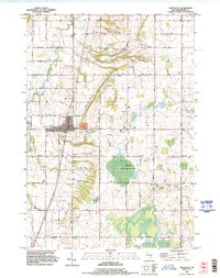
The unincorporated community of Greenleaf stands as a focal point in southern Brown County, situated where the E River winds through a landscape defined by its agricultural and early transportation roots. The presence of Old Military Rd hints at the region's historic connectivity, while the more modern small-craft aviation facilities at Birch Creek Airport and C R Acres Airport reflect a transition in local land use. Further south, the settlement of Askeaton anchors a community deeply tied to local heritage, evidenced by the path of Saint Pats Church Rd. The terrain is scattered with sites of local genealogical interest, including Fairview Cem and Saint Johns Cem, which remain as quiet landmarks within a grid of county roads and family-named thoroughfares. The drainage patterns of the Br River further shape this corner of Wisconsin, where the layout of section lines and township boundaries continues to dictate the rural character.
Find a feature on this map
68 named features on this map. Tap any name to fly to it.
Don’t see what you’re looking for? This feature index may not catch every label — zoom into the map to look around manually.
Map Details
Editions of this 2022 Greenleaf Map
This is the sole edition of this map. No revisions or reprints were ever made.
Historical Maps of Morrison Through Time
3 maps found