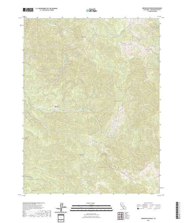
2021 Map of Greenough Ridge
USGS Topo · Published 2021About this map
Greenough Ridge and the Greenough Roughs dominate this portion of Mendocino County, where the landscape is defined by the complex drainage of the Big River and its various branches. The area is marked by numerous family-named openings and high points, such as the Hans Ottoson Opening and Williams Peak, suggesting a history of high-elevation ranching and forestry. Narrow access roads like Muir Mill Rd and Williams Ranch Rd wind through the hills, providing connections between isolated points like Irene Peak and the drainage of Baechtel Cr. The density of named gulches, including Pigpen Gulch and Bowman Gulch, reflects a deeply dissected terrain where water management and timber access were likely primary concerns for local residents and landowners in the 21st century.
Find a feature on this map
41 named features on this map. Tap any name to fly to it.
Don’t see what you’re looking for? This feature index may not catch every label — zoom into the map to look around manually.
Map Details
Editions of this 2021 Greenough Ridge Map
This is the sole edition of this map. No revisions or reprints were ever made.
Other maps of this area

1920 · Glenblair
USGS Topo · 1:62,500

1922 · Willits
USGS Topo · 1:62,500

1942 · Willits
USGS Topo · 1:62,500

1943 · Glenblair
USGS Topo · 1:62,500

1943 · Boonville
USGS Topo · 1:62,500

1943 · Navarro
USGS Topo · 1:62,500

1944 · Willits
USGS Topo · 1:62,500

1944 · Saddle Point
USGS Topo · 1:62,500

1957 · Ukiah
USGS Topo · 1:250,000
1959 · Boonville
USGS Topo · 1:62,500