2024 Map of Greenway
USGS Topo · Published 2024About this map
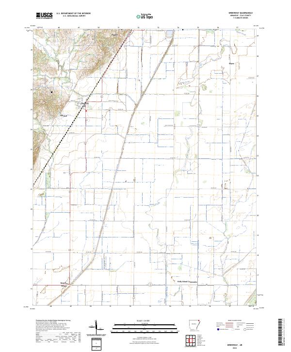
Crowleys Ridge defines the western margin of this Clay County landscape, creating a distinct topographic break from the low-lying wetlands to the east. The town of Greenway is situated at this geographical junction, where the higher ground meets the flat agricultural plains. This transition is underscored by a sophisticated water management system of engineered waterways like Slough Drainage Ditch and Big Slough Ditch, which work to drain the historic bottomlands once dominated by Middle Slough.
Find a feature on this map
69 named features on this map. Tap any name to fly to it.
Don’t see what you’re looking for? This feature index may not catch every label — zoom into the map to look around manually.
Map Details
Editions of this 2024 Greenway Map
This is the sole edition of this map. No revisions or reprints were ever made.