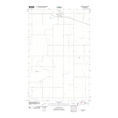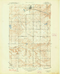
1948 Map of Grenora
USGS Topo · Published 1948About this map
Grenora stands as the primary hub in this corner of Williams County, anchored by the Great Northern railroad line that cuts through the northern plains. This 1946 survey, published just after the war, reveals a landscape defined by both agricultural settlement and early extraction, evidenced by the Fulves Mine to the south. The distribution of rural education is well-preserved here, with Barr Butte Sch, Liberty Sch No 1, and Roosevelt Sch serving scattered farmsteads. Terrain features like Barr Butte and Sowers Bluff provide verticality to the landscape, while the drainage of Cottonwood Creek and Willow Creek dictates the local topography. The map also delineates township-scale districts including Grenora, Glimax, and Good Luck.
Find a feature on this map
14 named features on this map. Tap any name to fly to it.
Don’t see what you’re looking for? This feature index may not catch every label — zoom into the map to look around manually.
Map Details
Editions of this 1948 Grenora Map
This is the sole edition of this map. No revisions or reprints were ever made.
Historical Maps of Grenora Through Time
6 maps found