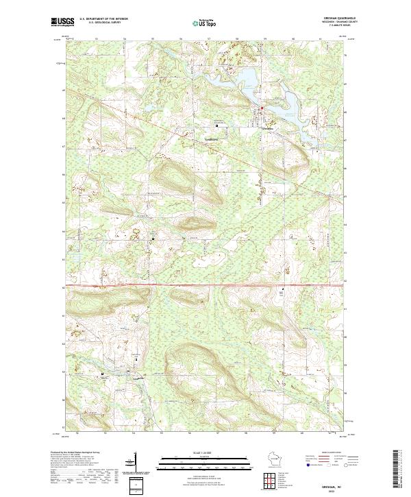
2022 Map of Gresham
USGS Topo · Published 2022About this map
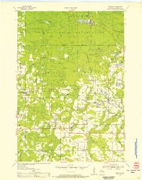
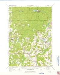
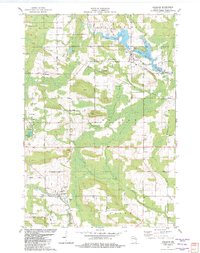
The Red River and its impoundments, Upper Red Lake and Lower Red Lake, dominate the northern portion of this Shawano County landscape. The village of Gresham serves as the primary hub, situated near the water's edge where several local roads converge. Further south, the rural character is defined by the North Branch Embarrass River and the small settlement of Leopolis. This area is particularly detailed for genealogists, as it includes numerous local burial sites such as Saint Francis Solanus Cem and Saint Johns Lutheran Cem, often positioned near rural crossroads and early community centers like Lyndhurst. The Mountain-Bay State Trl cuts across the terrain, tracing a corridor that follows old transportation patterns through the woodland and marshy areas near Kegoening Lake and Smith Lake.
Find a feature on this map
59 named features on this map. Tap any name to fly to it.
Don’t see what you’re looking for? This feature index may not catch every label — zoom into the map to look around manually.
Map Details
Editions of this 2022 Gresham Map
This is the sole edition of this map. No revisions or reprints were ever made.
Historical Maps of Seneca Through Time
4 maps found